

Video Message by Professor Salim Al-Hassani to the“Science and Technology in Islamic Civilization” conference
by Media Desk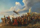


When dealing with Turkish history, whether during the Ottoman period or after, one comes across horrendous claims and errors by countless historians which utterly distort the subject. To try and write correctly Turkish history is beyond the competence of this author, nor is it his aim, nor his bother. It is up to Turks themselves to write their own history. Nobody is going to write it correctly for them.
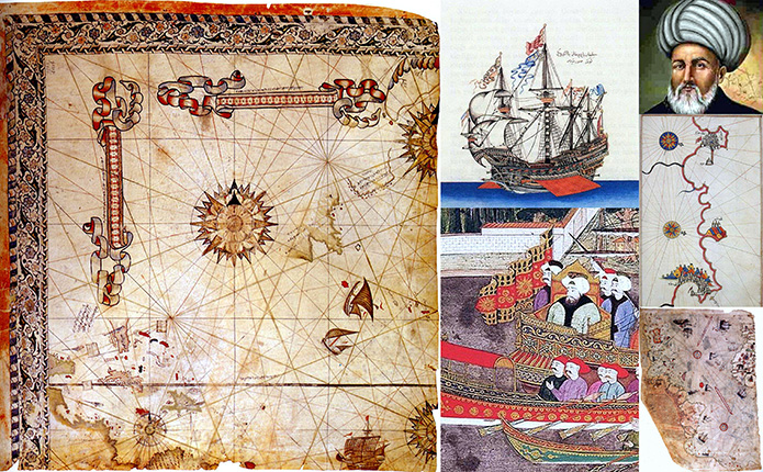
Figure 1. (Map on left) Surviving fragment of the second World Map of Piri Reis, 1528 (source)
 Figure 2. Turkish Piri Reis Stamp |
Also, whilst Western sources of Turkish history, just as of Muslim history, are a blessing, they can also be the greatest curse for whoever fails to handle them carefully. They are so full of the dire and the best at once, and whoever comes in and begins to pick blindly is just going to complete a mishmash of the best and the dire. Furthermore, many researchers these days, due to countless reasons that include laziness, search for the easy, gullibility, lack of experience, poor scholarship, and the like, quickly click on the internet, pick up the first information that hits their eyes, compile a poor paper and present it to their peers, or students, or their employer, and add their latest ‘creation’ to their cvs, and then savour the resulting rise in their emoluments. Of course, few understand that the internet is also a blessing and a huge scourge, that in regard to knowledge, it operates or does what it does to news or the truth. The internet, or the invisible hands behind it, select for you the knowledge they want you to know, and the names they want you to consider as great scholars, just as they select for you the news that tells you the truth, that is their truth. Many indeed fail to realize that there are vast amounts of true knowledge that are hidden away, that only an experienced researcher can fathom. Finally, we live in a world that is awfully corrupted by the glitzy and the urge for the latest when the glitzy and latest are just all glitz and no substance. Unfortunately, the trend amongst mediocre scholarship is to succumb to this glitz, and adopt blindly the most recent sources. Let’s remind them again: you do not adopt or trust a source, or use it because it dates from after 2000. This is utterly wrong. In respect to our subject, history, most of the best material precedes 2000, and in fact, the older the source, the better. By this, one means, history is not technology or medicine, whereby you adopt the latest source giving you the latest findings. History is the very reverse. The closer you get to the event the better. Talking about Turkish history for instance, it is better to use a war correspondent who was present during the Balkan Wars (1911-1913) or at the Gallipoli campaign (1915) than use any source of today, E.J. Erickson and Mesut Uyar, both first class historians, excepted. Always stick with the contemporaries, and if you can’t then use those who lived closer to the events, and then, finally, if you have to, which you do, use later scholars in order to get some benefit of hindsight, or to correct errors which earlier sources might have made in regard to names, or some dates, and the like.

Figure 3. Painting of Sultan Ahmed III and Ottoman bastardas (small war galleys) in Surname-i Vehbi. (Source)
Now, why is one reminding of all this? The reason is simple: one has read some dreadful stuff, including by countless Turkish scholars, some going even further than their Western colleagues or masters, in seeing in their ancestors involved in maritime activities only corsairs who loot Christian wealth and slay their victims in most atrocious manners. The Anti Turkish propaganda in historical narrative is in fact the mother of all propagandas, with perhaps not more than 10% written about Turks being of any historical veracity whatsoever. This author has discussed this issue to great length in his other works, and is not a liberty to go into such a matter here. In regard to our particular subject, reading through most works, it would seem, every Turk who set sail, or just approached the sea, was a sanguinary pirate. This is a serious error committed by many. Turkish navy commanders, especially the two Barbarossa Brothers, Piri Reis and other admirals were never corsairs. This is a legend, a myth, a distortion, a dreadful exploitation of history which hides, or in fact reflects, the centuries old hostility to the Turks, and which expresses itself in distorted writing.
In this article we begin by addressing distortions related to the subject, first, before we deal with Piri Reis and other aspects of Ottoman maritime history. This is necessary not just because the distortions need to be addressed, it is also for another simple reason: unless we deal with these distortions we understand nothing whatsoever about Ottoman naval history. Also, as stated above, this author is not going to substitute himself to Turkish scholarship and start lecturing the Turks about their history. They are better placed than him to do it. So, he deals with this issue here because this is necessary, and also because he is not going to devote to it any further interest or energies any time in the future as the whole Muslim history is in urgent need of salvation from the onslaught unleashed on it for more than a century under the complacent or culpable Muslim eye.
There are three main aspects to the distortions of Turkish/Ottoman maritime history:
1. Attributing to Ottoman seamen the title of corsairs/pirates.
2. Attributing Ottoman accomplishments to others.
3. Hiding away/suppressing from knowledge sources and information that tell the real story.

Figure 4. Exquisite drawing of a Goke, an Ottoman war ship. Miniature taken from Katip Celebi’s manuscript Tuhfetü ‘l-kibar (Topkapi Palace Library, MS R1192). (Source)
We begin with the practice of assimilating Ottoman seamen to corsairs.
Soucek, who straight, in the abstract of his article on Piri Reis, informs us:
Piri Reis (ca 1480-1553) was an ottoman-Turkish corsair, admiral in the imperial navy, and, most importantly, author of portolan charts and sailing directions as well as of two world maps. His early life as a gazi-corsair, approximately from 1490 to 1510, was spent by the side of his uncle Kemal Reis, a renowned corsair with whom he criss-crossed the Mediterranean, gaining unparalleled knowledge of this sea.[1]
The same author in another article:
![]() Piri Reis (ca 1481-1552) he is believed to have sailed with his uncle Kemal Re’is, the corsair who took part in the Ottoman capture of Euboea (874/1470).”[2]
Piri Reis (ca 1481-1552) he is believed to have sailed with his uncle Kemal Re’is, the corsair who took part in the Ottoman capture of Euboea (874/1470).”[2]
Dimitris Loupis makes sure Kemal Reis is both corsair and pirate at once.[3] He writes:
![]() During Bayazid’s reign, Pïrï Reis (ca. 1470-1553/4) grows mature in the Aegean and Mediterranean Seas next to the
famous pirate and corsair, his uncle Kemäl Reis.”[4]
During Bayazid’s reign, Pïrï Reis (ca. 1470-1553/4) grows mature in the Aegean and Mediterranean Seas next to the
famous pirate and corsair, his uncle Kemäl Reis.”[4]
Imber states:
![]() In the first decade of the sixteenth century, two brothers, Hayreddin Barbarossa and Uruj, had been active in piracy off the southern and western shores of Anatolia, enjoying the patronage of Bayezid’s son, Korkud. Selim I’s execution of Korkud and pursuit of his followers in 1513 forced the brothers to flee to the North African coast, where they established themselves not simply as pirates, but eventually as rulers of Tunis and Algiers.”[5]
In the first decade of the sixteenth century, two brothers, Hayreddin Barbarossa and Uruj, had been active in piracy off the southern and western shores of Anatolia, enjoying the patronage of Bayezid’s son, Korkud. Selim I’s execution of Korkud and pursuit of his followers in 1513 forced the brothers to flee to the North African coast, where they established themselves not simply as pirates, but eventually as rulers of Tunis and Algiers.”[5]
Andrew Hess, likewise, says:
![]() Responding to an appeal for aid from the Muslims of Granada, Bayezit II outfitted a corsair squadron under the command of Kemal Reis for operations in Iberian waters.”[6]
Responding to an appeal for aid from the Muslims of Granada, Bayezit II outfitted a corsair squadron under the command of Kemal Reis for operations in Iberian waters.”[6]
Hess also writes:
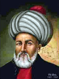 Figure 5. Portrait of Piri Reis (Source) |
![]() Ottoman imperial activity within North Africa started shortly after the seizure of Egypt when Selim the Grim (1515-20) sent military units westward as far as the borders of Tunisia.[7] In approximately the same period, Muslim corsairs from the eastern Mediterranean, the Barbarossa brothers, petitioned the Ottoman sultan for military assistance in order to protect the privateering bases they had established along the coast of the Central Maghrib.”
Ottoman imperial activity within North Africa started shortly after the seizure of Egypt when Selim the Grim (1515-20) sent military units westward as far as the borders of Tunisia.[7] In approximately the same period, Muslim corsairs from the eastern Mediterranean, the Barbarossa brothers, petitioned the Ottoman sultan for military assistance in order to protect the privateering bases they had established along the coast of the Central Maghrib.”
When Suleyman the Lawgiver (1520-66) supplied arms, ammunition and men to these frontiersmen and in 1534 appointed their leader, Hayreddin Barbarossa, to the post of admiral, he projected the boundaries of the Ottoman empire into the western Mediterranean basin.[8]
We will deal with the Ottoman corsair concept further down. Let’s first address the shortcomings of Western scholarship, by making few comments on Hess’s preceding statement. It is full of errors; in fact the whole of Hess’s essay shows his utter poor understanding of the North African and Spanish scene. It is not our remit here to deal with the work, but only focus on the statement made a few lines above. Hess messes his dates as rarely historians do. We bring to attention that Selim ‘The Grim’ (as in his words) was sultan in 1512, not 1515; he descended on Egypt late in 1516, captured it in 1517. The Barbarossas had by then been established in North Africa for quite long; had defended Jerba in 1510, had established themselves in Jijel; Aruj had by then launched two assaults to free Bejaia from the Spaniards; and with their Algerian allies, the Barbarossas had freed Algiers from Spanish tutelage, in 1516. They had also received armament, including ships, from Selim and not under Suleiman. By the time of Suleiman, in fact, Aruj was already dead, and could not receive anything from the sultan (except his blessings). The circumstances of the Brothers’ arrival in the region and their acts there contradict everything Hess says. He only got right the fact that Suleiman appointed Kheir Eddin as head of the Ottoman navy, but here, too, he got his date wrong, for Kheir Eddin was appointed in 1533, and maybe even in 1532, and not in 1534, for in 1534, he was already in command of a powerful fleet setting out of Istanbul aiming for southern Italy.[9] After all, he was in Algiers when he received his appointment, and in those days, it took a bit longer to travel from Algiers to Istanbul, go through the various procedures, and prepare a fleet. His program was too crammed to make the date of his appointment 1534, for that same year, also, when asked by the Tunisian population to free them from their despotic ruler, he entered Tunis.[10] Just by using logic one can find problems with Hess’s dating of everything.
We won’t dwell on the matter of the supposed ‘Barbarossa’s flight from Turkey to the western Mediterranean to commence their corsair activities.’ Dates and circumstances given by Hess and Imber are contradicted by all contemporary sources and also older Western sources.[11] These dates and circumstances are only upheld by Soucek, Imber and Hess and their gullible followers.[12] Neither dates nor circumstances tally with other facts or historical logic. In regard to the latter, the dates given by Soucek, Hess, and Imber (and their followers) make the accomplishments of the Barbarossa Brothers in the Western Mediterranean impossible.
But let us focus on the matter of piracy: The story goes back to 1501. That year Arruj and Elias, his brother, most certainly as they carried the family wares (their father was a pottery maker) off Mytilene, were surprised at sea by a pirate galley of the Christian Knights of St. John of Jerusalem, based at Rhodes.[13] Elias was killed on the spot (possibly deemed not worth enslaving) whilst Arruj was, like most physically able Muslims who were caught, sent to Christian galleys, where he slaved at the oars for three years.[14] This incident fits in very logically with the events of the time as meticulously drawn from official sources, for precisely that same year, 1501, Venetian and French forces tried to capture the island of Mytilene as a suitable base for operations against the Dardanelles.[15] After Arruj’s ransom (in 1504), an Egyptian emir outfitted him and his other two brothers (Isaak and Khair Eddin) to raid Christian merchants.[16] This shows that it was not the brothers who were pirates but that they were themselves victims of Christian piracy.
Regarding what brought the brothers to prominence in North African politics, where they supposedly engaged in piracy, only a historian who knows a little about the history of North Africa can explain it to the others, and without such knowledge the lives and careers not just of the Barbarossas, but also of Piri Reis himself, and the whole Ottoman maritime history especially in the western Mediterranean, will never be understood. So let’s clarify the situation for everyone:
Following the fall of Grenada in 1492 the Spaniards embarked on their long-held project of ‘recovering Christian lands’ on the other side of the sea (the Maghrib), a project that is so well documented that only idiots can speak of other causes for the Spanish military onslaught against North Africa.[17] The Spaniards, just as the Portuguese nearly a century before them, began occupying (after the usual massacres of Muslims) towns and cities on the coast of modern-day Morocco, Algeria, Tunisia, and Libya. In 1415, long before the Ottoman ‘corsairs’ grand fathers’ were born, an army of over 50,000 men and a navy in excess of 230 vessels took Ceuta for Portugal.[18] The capture of Ceuta was followed in 1437 by the first abortive crusade against Tangier, and, under Alfonso V the African (o Africano, 1438-1481), by the seizure of Arzila (1458).[19] In 1471, Tangiers capitulated to the Portuguese.[20] In 1485 the kingdom of Fez made a treaty of peace and friendship with the Spanish monarchs, and became in 1494 the subject of two partition treaties between Portugal and Spain.[21] By the early 16th century, during Don Manuel’s reign, the Portuguese were strongly established in fortified settlements in Agadir (1504), Safi (1508), and Azemmour (1513).[22] These conquests were seen as one of the prongs of a proposed attack ‘to liberate Jerusalem from Infidels,’ in pursuit of which the Portuguese tried and failed to take Mers al-Kebir (Algeria) in 1501.[23] In the wake of Portuguese conquest, terrible acts of cruelty were committed on Muslims, and countless numbers were enslaved.[24]

Figure 6. The surrender of Granada in 1492 (Source)
This ‘Re-conquest’ beyond the Iberian Peninsula was justified on the ground that ‘North Africa too had once been a Christian land.’[25] The Spaniards continued the ‘Holy duty.’ Melila was captured in 1497, Mers el Kebir (1500), Oran (1509), Bejaia and Tripoli in 1510.[26] When Algiers and Tunis became threatened in 1510, following the Spanish capture of Bejaia and Tripoli, the local sheikhs, in quite normal tradition of the time (as was done before then by the sheikhs of Grenada), called for Ottoman help. The two brothers had already established themselves on the island of Jerba (modern Tunisia).[27] Arruj might have even helped local authorities in Jerba in repulsing the Spanish attack on the island in that year (1510).[28] Arruj and Kheir Eddin established themselves at Jijel (Lesser Kabylia) in Algeria, the nearest town to Bejaia, which they intended to free from Spanish rule.[29] Then, aware of the presence of the two brothers in Jijel, a delegation arrived from Algiers to request them to help wresting Algiers from Spanish garrison on the Penon and ending the annual tribute.[30] Although Algiers had a large Andalusian community, the political leadership was exercised by Salim al-Tha’alibi, chief of the Tha’aliba tribe which had ruled the city shortly before Pedro Navarro’s campaign of 1510.[31] The Spanish presence weighed heavily on the Algerians, who not only paid tribute but were also continually threatened by the cannons of the Penon.[32] King Ferdinand the Catholic, says Lane Poole, ‘held a firm hand over the tribute which his banished subjects had to pay him for his condescension in ruining them.’[33] The people lacked the required armament to even bother let alone dislodge the Spaniards. Arruj’s help was sought, for, as Lane Poole puts it:
 Figure 7. Suleiman the Magnificent receiving Barbarossa in Istanbul (Source) |
![]() And who so proper to redress this grievance as the invincible Barbarossa, who was master of a naval force, and wanted not artillery? Had he not been twice to reinstate the unfortunate King of Bujēya, and lost a limb in his service?”[34]
And who so proper to redress this grievance as the invincible Barbarossa, who was master of a naval force, and wanted not artillery? Had he not been twice to reinstate the unfortunate King of Bujēya, and lost a limb in his service?”[34]
Arruj, with his Algerian allies, led by Ibn al-Kadi,[35] entered Algiers in 1516, and were received with great rejoicing by the citizens.[36] Hence began the story of the Algerian-Ottoman collaboration that was to last for centuries. So this is the reason why the brothers came to Algeria, and this is the reason that drove Turks and Algerians to fight together not that Algerians and Turks have engrained in them the gene of loot and plunder as the authors above make it look. To confirm what has been stated, one only looks at the history of the Ottomans, in general, and the Ottoman navy as summed up in the final heading oft his work (Heading 3: The Wider Cause).
Finally, the claim (as is also found in most works) that the two brothers were mere pirates is utterly disproved by historical facts in their entirety. Arruj, rather than engaging in “pirate” activities, allied himself with the Algerian local population of both Jijel and Bejaia, and mounted successive assaults on land to free the latter city, but failed due to superior Spanish artillery, even losing an arm in one attempt.[37] Arruj did not then, again as stated by our scholars, launch onto the sea from Algiers to terrorize Christian shipping. It is a challenge upon anyone to show a single attack by him on any ship or any coastal area of Christendom mounted from Algeria. The fact is: he spent all his time and effort with his Algerian allies first in liberating Algeria from the Spaniards, Algiers first in 1516.[38] After that, he spent the remaining time of his life fighting on land various Spanish assaults against Algeria.[39] The respect he obtained from the locals made him at once their trusted military commander, who not only read the khutba on Friday at the main Mosque in Algiers, but he also accepted as the leader of Algiers and what then formed the Algerian state.[40] Arruj and his brother were never the enemies of Selim I, any correct reading of history shows that instead they asked for, and obtained his support, including his sending of ships to them and more men.[41] Arruj died not at sea attacking a ship of some sort, but instead was killed on land, as he was trying to expand the Algerian state as we know it today.[42] He died alongside his faithful local allies, in the western Algerian town of Tlemcen or just outside in 1518, in a land battle with the Spaniards.[43]
Kheir Eddin continued his brother’s task. He fought on land, again with his Algerian allies, the countless Spanish landings in Algeria. He conducted operations to recapture the Penon from the Spaniards.[44] Following that Kheir Eddin did not once capture a civilian ship, but instead led the Ottoman navy in some of its great victories at sea, Prevesa in 1538 being his greatest accomplishment. Before that, once hailed by the Algerians as the successor to this brother, and with his Algerian allies, he continued his brother’s edification of a strong state, courted, feared, hated, and admired (all at once) by about all: the French, the English, and even the Americans, down to the early 19th century.[45] Kheir Eddin, rather than being a pirate, also became the Kapudan Pasha of the Turkish navy, and also the builder of the French naval strength, liberator and guarantor of French independence from the Empire (of Charles V), and such was his preponderance in French politics, when he stayed in the French southern town of Nice, the Churches were ordered not to ring their bells so as not to disturb ‘the Great Admiral.’[46] And it was not Kheir Eddin who burnt down the city of Nice,[47] or committed the outrages attributed to him but it was the work of the French he was helping to keep their nation free.
In fact, Fisher enlightens us on how the perception of Kheir Eddin evolved thanks to Western historiography. He notes how, contrary to contemporary sources, which had the highest esteem for Turkish seamen and their commanders, especially the Barbarossa Brothers, with time, such descriptions grew worse as a result of spiteful anti Ottoman narrative. By the time we reach our day, Kheir Eddin is only known as a ‘professional pirate, such depictions of him and his North African allies stressing ‘their plunder and barbarity.’[48] It is frequently stated that the ‘Algerian pirate’ Kheir Eddin seized the kingdom of Tunis from an unoffending neighbour, made himself king, and delivered up the defenceless city to the fury of his janissaries.[49] (Actually he went there on the orders of the sultan to install a more popular ruler, was received with open arms by Tunis inhabitants, and accomplished his task without bloodshed.[50] When the Christians made a counter-invasion in 1535, he refused to take the precaution, which Europeans did in similar circumstances,[51] of killing his Christian captives, and perhaps owed his defeat to that lack of ruthlessness.[52] On capturing Tunis, Charles V delivered the city to an orgy of killing and destruction hardly known in history.[53] This ‘liberation of the country from ‘the pirates’ is actually cited today as enhancing the power and prestige of the emperor and Christendom.’[54] Some forty years later Charles’s example was followed by his son Don Juan in very similar circumstances.[55]

Eric Chaney in his article: Measuring the Military Decline of the Western Islamic World: Evidence from Barbary Ransoms; March 20, 2015;[56] states the following:
Interestingly, this timing coincides with what one military historian has called the Ottoman Empire’s first “significant military failures”[57] suggesting that the start of the decline of the corsairs coincided with that of the rest of the Empire. In this sense, the results complement the large literature dating the start of the Ottoman decline between the sixteenth and eighteenth centuries and contribute to the naval and military history of the Ottoman Empire more generally.[58]
He pursues:
![]() The rise of the Ottoman Regency of Algiers is directly linked to the maritime expansion of the Ottoman Empire. As the Empire sought to increase its naval capabilities at the end of the fifteenth century, it recruited corsairs who “quickly raised the technical competence of the Ottoman navy”.[59] Just as the Ottomans had turned to corsairs to address the earlier Venetian threat, they turned to Levantine corsairs for aid in their conflict with the Habsburg Empire in the first decades of the sixteenth century. Khair al-Din or “Redbeard” is perhaps the most famous of these corsairs. He established himself as ruler of Algiers in 1516 and eventually received Ottoman military aid in his struggle against the Spanish. These corsairs soon became “the main agents with which the Ottomans attacked the Habsburgs in the western Mediterranean”[60] and included European Christian renegades as well as Muslims from the Levant.”[61]
The rise of the Ottoman Regency of Algiers is directly linked to the maritime expansion of the Ottoman Empire. As the Empire sought to increase its naval capabilities at the end of the fifteenth century, it recruited corsairs who “quickly raised the technical competence of the Ottoman navy”.[59] Just as the Ottomans had turned to corsairs to address the earlier Venetian threat, they turned to Levantine corsairs for aid in their conflict with the Habsburg Empire in the first decades of the sixteenth century. Khair al-Din or “Redbeard” is perhaps the most famous of these corsairs. He established himself as ruler of Algiers in 1516 and eventually received Ottoman military aid in his struggle against the Spanish. These corsairs soon became “the main agents with which the Ottomans attacked the Habsburgs in the western Mediterranean”[60] and included European Christian renegades as well as Muslims from the Levant.”[61]
He says:
![]() In addition, during the period covered by the data used in this paper, there are many examples of the Ottoman Grand Admiral (kapudan pasha) being drawn from the ranks of the Algerian corsairs. This is a reflection of the “crucial” role the corsairs played in the Ottoman navy during this period.[62] This central role is thought to have derived from the superior technological capabilities of the Algerian fleet, which enhanced the quality of the Ottoman navy up until it abandoned its Mediterranean policy in the early 1580s.”[63]
In addition, during the period covered by the data used in this paper, there are many examples of the Ottoman Grand Admiral (kapudan pasha) being drawn from the ranks of the Algerian corsairs. This is a reflection of the “crucial” role the corsairs played in the Ottoman navy during this period.[62] This central role is thought to have derived from the superior technological capabilities of the Algerian fleet, which enhanced the quality of the Ottoman navy up until it abandoned its Mediterranean policy in the early 1580s.”[63]
Prior to this disengagement, the Ottomans achieved mastery of the Eastern Mediterranean and under the command of Khair al-Din, the Ottoman threat spread to the Western Mediterranean. Following the battle of Prevesa -in which the Ottoman Navy defeated the combined forces of Spain, Venice, Genoa, the Papal States and the Knights of Malta in 1538- the Ottomans dominated the Mediterranean until the battle of Lepanto in 1571.[64] After repelling a Spanish invasion of Algiers in 1541, Khair al-Din captured Nice in 1543 and the Ottoman fleet destroyed a Christian fleet at Djerba in 1560.[65] Following failures at Malta and Lepanto, the 1574 Ottoman conquest of Tunis marked the effective end of major hostilities in the Mediterranean between the Ottomans and the Spanish.”[66]

Figure 9. Map of Europe, the Mediterranean sea and North Africa from Kitab-i Bahriye by Piri Reis (Source)
During the first half of the seventeenth century, the Algerian corsairs pulled further ahead of the core Ottoman regions in the realm of naval technology. This divergence is thought to have been crucially aided by the influx of Dutch and English pirates into the Regency following Spain’s peace agreements with England and the Netherlands in the first decade of the seventeenth century.[67] Given that during this period many Algerian corsairs had previously served “in professional armies for France, England, or the United Netherlands before renouncing their religion”[68] it is perhaps not surprising that the corsairs were able to compete on roughly equal terms with the English and Dutch.[69]
And he concludes:
![]() These decades witnessed the height of the corsairs’ power[70] and the Algerians are believed to have possessed the Islamic world’s most advanced fleet through the end of the seventeenth century. Indeed, the Algerians provided “the Ottomans with an invaluable reservoir of naval experts” during this period.”[71]
These decades witnessed the height of the corsairs’ power[70] and the Algerians are believed to have possessed the Islamic world’s most advanced fleet through the end of the seventeenth century. Indeed, the Algerians provided “the Ottomans with an invaluable reservoir of naval experts” during this period.”[71]
As an Algerian, the author would have loved it if Chaney’s words were true, unfortunately his facts do not tally with historical reality. As we will see in the final heading of this work, it was not the Algerians who got the Ottomans out of trouble, but in fact the Ottomans who got the whole Muslim world out of troubles. This website as one reminds is not the place for scholarly controversies which hence curtails the ardour of this author, limiting him to raising the following points only to point to the unfortunate flaws in Chaney’s argument before drawing the main conclusion.
Firstly, you cannot write any history on any subject unless you use all good sources available to you, once more including the old ones. You cannot write anything on the so called North African or Barbary Corsairs unless you use the people who have real grasp of the subject, and here one is referring to Godfrey Fisher, first and foremost, and then the likes of Matar, Earle, Spencer, and Mathiex. If you used these sources your views of the whole matter should be altered, of course.
 Figure 10. Drawing of the cities of Algiers and Bejaia in Kitab-i Bahriye by Piri Reis (Source) |
Just a few errors as space limits us to deal with all: in p. 6 Channey states that Kheir Eddin defeated the Spaniards in 1541 in Algiers. This was not the case at all. Kheir Eddin was thousands of miles away, and did not have a single shot or any involvement of any sort in this operation. The Algerians repelled the Spanish invasion on their own (with Allah’s help according to every devout person as a terrible storm wrecked the Christian armada). Nice was not captured by him. It was a Franco-Ottoman joint operation. Contrary to what Chaney claims, not a single Dutch or English seaman of note came to the Algerian Regency in the first half on the 17th, or at any other time, for that matter, or brought any sort of know how in regard to naval technology. The one sea commander, so called renegade, who arrived in Algiers and brought some ships with him, and did much for the Algerian navy was Ali Betchin (d. 1645) a Venetian. The Algerians never had any naval technological know how beyond that of building small ships. All their sophisticated, large, ships were those captured from the enemy. The true, effective, shipyards were all in Ottoman Turkey. When both Kheir Eddin and Uludj Ali (the latter after Lepanto) refitted the Ottoman navy, they did not do it in Algiers, or Jijel, or anywhere in Algeria, they did that in Istanbul. This information is widely available, and a good source such as Casale, unfortunately not used by Chaney, could have helped avoid these terrible errors.
The point one is making here is this: There is no point in demeaning the Ottoman contribution to naval history or any sort of history. Facts are here to prove this, and only fruitful use of good sources can help avoid these mishaps.
Brice and Imber, to their credit, in a note addressed to the Geographical Journal, observed that although European charts of the Mediterranean have received much focus, none has seriously considered similar Turkish maps.[72] Even worse, ‘European scholars have dismissed Turkish works as being of Italian origin imported into the Ottoman Empire, or the work of Italian renegades,’ which Brice and Imber went on to demonstrate was without foundation of veracity.[73]
In 1518, Salman Reis, Goodrich (who knows his subject) notes,[74] went a long way to correct the overall impression, giving excellent accounts of the Ottoman descriptions of the New World as it was then being discovered in all its strangeness, variety and richness.
Giancarlo Casale, in perhaps one of the best written introductions one can ever come across, in fact not just a summit of scholarship but also of pure literature, telling you all you need to know about the whole subject in just two pages. In these pages, after lending real Ottoman accomplishments (including military and commercial expansion, putting in place convoys of state-owned ships to bring pepper and cloves to the spice bazaars of Egypt, bankrolling burgeoning elites, developing the sciences of geography and cartography…) to an imaginary Byzantine empire (not conquered by Mohammed II), Casale says:
So what about the Ottomans? It just so happens that the Ottoman Empire accomplished in the real world of the sixteenth century every one of the things that the virtual Byzantines accomplished only in our imagination. Yet astonishingly, no serious attempt has ever been made to portray these Ottoman achievements as part of the larger story of physical expansion abroad and intellectual ferment at home that characterized Western European history during precisely the same period.[75] Herein lies the central question of this book. Stated simply, it asks: “Did the Ottomans participate in the Age of Exploration?” The answer, also stated simply, is yes.[76]
And then, Casale, more proficiently than any other historian of the subject examined by this author, and there are many of them, proceeds to enlighten us on the real contribution of the Ottoman navy during the new Age of Exploration. It will be vain task by this author should he try to reproduce Casale’s arguments showing the scale of the Ottoman achievements. Everyone is invited to read Casale himself, for thanks to his work one is truly informed. Much better, one does not come across the dire that one finds in other works, for he, Casale truly knows his subject, and most of all does not let his emotions, whether favourable or unfavourable to the Ottomans, affect his scholarship, which is by far the greatest accomplishment, sorely missed amongst others.
There are quite a few techniques to distort history, and a number of scholars have devoted their energies and works to show how history is a vastly distorted subject.[77] One of the techniques is to not just to remove facts, but also sources of facts, and even remove centuries from knowledge if that serves to distort the subject as noted by Glubb.[78]
Our focus here is on the misuse of sources. Instead of citing the sources they disagree with, or sources that convey facts they deem false, and then showing them to be wrong, or making counter arguments, most weak historians avoid altogether mentioning them. The practice of suppressing many sources of Islamic history has in fact become an epidemic. The suppression does not affect tens of sources, it affects hundreds. When one browses though such sources that can hardly be found in our modern bibliographies or reading lists, one is stunned not just at the fact that such sources, with hardly any exception, are favourable to the Islamic side of history, one is stunned at their immense high quality.
Let’s see here in regard to our subject how ignoring or setting aside some sources for whatever reason: either not finding them, or just mere dishonesty and incompetence. We won’t accuse our historians who do that of the last two, but just say that they failed to use such sources out of utterly innocent reasons (hence no incompetence and no dishonesty involved).
As we have seen in the heading above, one of Chaney’s worst flaws was the lack of use of the right sources, or at least sources that could have made him question his erroneous claims. Most of the excellence of the literature on the naval history of the Ottomans, and especially in relation to the Western Mediterranean, is found in old French sources, and also Spanish, most particularly as follows:
 Figure 11. surviving fragment of the first World Map of Piri Reis held at the Topkapi Museum in Istanbul (Source) |
Now, if you use these sources, you can be guaranteed you will have a full view of the history of the Ottomans, and a very good idea of the so called Barbary Corsairs. It will avoid you making errors which even the so-called proficient scholars make, at times horrendous errors which utterly mislead the reader.
Let’s show some instances of how poor use of sources (again we insist not due to incompetence and dishonesty) leads its authors into making claims that awfully distort history. We stay with our subject, of course.
We have seen how to all modern scholarship, and in this including Muslims, consider every Ottoman seaman a corsair. However, their naming changes when it comes to Christians. Let’s begin with Hess and his colleagues who call ‘merchants’ the Portuguese who, from sometime in the 15th century, descended on North Africa and the Indian Ocean. Hess tells us that:
Warring Christian merchants descended upon the Atlantic coast of North Africa… with devastating efficiency.[79]
Thus the primary responsibilities of Spanish frontiersmen were static: to turn the inner barbarian against the outer in the manner of the Chinese governors responsible for the defence of the Great Wall, and to protect the coastline and commerce of Latin Christendom. Finally, the African generals were encouraged to stimulate trade and to make their outposts self-supporting.[80]
Hess contrasts for us the rather parasitic role played by Ottoman ‘corsairs’ with the constructive one played by the ‘merchants’ from Iberia:
![]() The limited, almost entirely coastal nature of these Spanish counterattacks implied a Christian acceptance of an Ottoman conquest won not by the slave armies of Suleyman the Lawgiver but by eastern Mediterranean sailors. With a great deal of derring-do, these seamen, who were thrown out upon Mediterranean frontiers by the violence attending the downfall of the Byzantine empire and the rise of the Ottoman sultanate, secured a foothold upon the coast of the Maghrib. Once established, the freebooters employed their familiarity with powder technology and their access to the resources of a highly centralized Muslim empire to carry on the holy war with painful results for the Christians.[81] Within the Maghrib, the naval vagabonds exploited their margins of military and political superiority to defeat the weak post-Almohad sultanates and to differentiate the state from a divided Maghribian society by imposing an alien ruling class.”[82]
The limited, almost entirely coastal nature of these Spanish counterattacks implied a Christian acceptance of an Ottoman conquest won not by the slave armies of Suleyman the Lawgiver but by eastern Mediterranean sailors. With a great deal of derring-do, these seamen, who were thrown out upon Mediterranean frontiers by the violence attending the downfall of the Byzantine empire and the rise of the Ottoman sultanate, secured a foothold upon the coast of the Maghrib. Once established, the freebooters employed their familiarity with powder technology and their access to the resources of a highly centralized Muslim empire to carry on the holy war with painful results for the Christians.[81] Within the Maghrib, the naval vagabonds exploited their margins of military and political superiority to defeat the weak post-Almohad sultanates and to differentiate the state from a divided Maghribian society by imposing an alien ruling class.”[82]
At the beginning the Ottoman frontiersmen were motivated by personal aims that cannot have differed much from the objectives of their Iberian counterparts. It was true that in the early stages of their expansion both operated as predatory warriors, Iberians, however, soon passed beyond a capricious looting of the frontier to favor a commercial form of imperialism, except in the New World, where the Spanish also began a territorial expansion and an organized extraction of minerals. The difference between the Ottoman and Iberian modes of imperialism where they met on the North African frontier was that nowhere in the Muslim case was there evidence of an institutionalized form of state capitalism or an aggressive merchant group driving the eastern Mediterranean sailors to acquire commercial rather than territorial advantages. It was not that the Ottomans were unaware of the economic implications of the oceanic voyages, in 1517 Piri Reis had informed the sultan of the Christian commercial ventures along the rim of Africa. Yet aside from the profits of freebooting, the Ottomans did not push the objectives of their maritime expansion into the Maghrib beyond imposing an agriculturally based tax system in an area where rich lands and a submissive peasantry were not abundant.[83] More than the conquest of new territories, what drew the Ottomans into North Africa was their imperial legitimacy.[84]
Hess is not alone, and many more with similar ideas could have been added. We only cite one: Chaudhuri writes:
![]() There is no doubt that in setting up an administrative structure in the capital city of Goa and in other lesser possessions and in exercising a quasi political control over the Indian Ocean traders to the West of the Malacca strait, the (Portuguese) Estado da India was being highly innovative.”[85]
There is no doubt that in setting up an administrative structure in the capital city of Goa and in other lesser possessions and in exercising a quasi political control over the Indian Ocean traders to the West of the Malacca strait, the (Portuguese) Estado da India was being highly innovative.”[85]
![]() How was it possible for a small and relatively obscure nation facing the Atlantic and outside the brilliant economic mainstream of the Mediterranean to achieve such status? Contemporary Portuguese historians and chroniclers depicted the early fidalgos in the east as belonging to a heroic band of conquistadors, comparable to the great Spanish soldiers in the New World…. The key to Portuguese success in the Indian Ocean lay in the military valour of Christian warriors sanctified by divine blessing.”[86]
How was it possible for a small and relatively obscure nation facing the Atlantic and outside the brilliant economic mainstream of the Mediterranean to achieve such status? Contemporary Portuguese historians and chroniclers depicted the early fidalgos in the east as belonging to a heroic band of conquistadors, comparable to the great Spanish soldiers in the New World…. The key to Portuguese success in the Indian Ocean lay in the military valour of Christian warriors sanctified by divine blessing.”[86]
We could devote a whole book countering these views, but a reading of extracts from Casale or sources cited above would do the job. In relation to North Africa, we have seen plenty of what the Iberians were up to, although we have been extremely careful not to depict their atrocities, in places similar to those they committed in south America. One tries to cut away as much as possible of the atrocious, but should anyone be interested, there are plenty of sources that can enlighten on that.[87] If Hess, just as Chauduri and others with similar views had read the likes of Crawfurd and Howitt, one can guarantee them their views of Iberian ‘merchants’ would be changed.[88] But let’s suppose they had difficulties accessing these two old sources, then, reliance on Boxer, who has by far done most on the Portuguese in the Indian Ocean could have helped them revise their views. They wouldn’t have needed to read Boxer at length, just stuck with the Introduction to his book written by Plumb,[89] and they could have read stuff such as this:
![]() The Portuguese [Plumb notes] had no shame in telling the stories of their pillage. As they relate, they bombarded on the slightest pretext the rich and prosperous ports of Africa, Persia and India, firing the houses, plundering the warehouses, slaughtering the inhabitants.[90] They butchered crews of captured Muslim dhows, slinging some from the yardarm for target practice, cutting off the hands and feet of others and sending a boatload of bits to the local ruler, telling him ‘to use them for a curry.’[91] They spared neither women nor children. In the early days they stole almost as often as they traded. They destroyed the long established routes that had bound the Far East and the Muslim World in a web of mutually profitable and largely peaceful commerce.”[92]
The Portuguese [Plumb notes] had no shame in telling the stories of their pillage. As they relate, they bombarded on the slightest pretext the rich and prosperous ports of Africa, Persia and India, firing the houses, plundering the warehouses, slaughtering the inhabitants.[90] They butchered crews of captured Muslim dhows, slinging some from the yardarm for target practice, cutting off the hands and feet of others and sending a boatload of bits to the local ruler, telling him ‘to use them for a curry.’[91] They spared neither women nor children. In the early days they stole almost as often as they traded. They destroyed the long established routes that had bound the Far East and the Muslim World in a web of mutually profitable and largely peaceful commerce.”[92]

Figure 12. Portuguese ships battling the Turks at Goa, by Theodore de Bry, 1620 (Source)
Michael Honig also writes:
![]() The Arab ship burned brightly on the Indian Sea. A pillar of flames leapt from the water. A funeral was underway. But this was not a noble burial like the Vikings of yore. Portuguese adventurers seeking to establish a trade route and eager for plunder boarded this merchant vessel and ravaged it thoroughly. They then locked the Arabs, many women and children, below the deck and burnt it whole. Such were the methods of the Portuguese. They did not come in peace but in pursuit of prosperity, by any means necessary.”[93]
The Arab ship burned brightly on the Indian Sea. A pillar of flames leapt from the water. A funeral was underway. But this was not a noble burial like the Vikings of yore. Portuguese adventurers seeking to establish a trade route and eager for plunder boarded this merchant vessel and ravaged it thoroughly. They then locked the Arabs, many women and children, below the deck and burnt it whole. Such were the methods of the Portuguese. They did not come in peace but in pursuit of prosperity, by any means necessary.”[93]
So, here one can only conclude that fortunate were the Muslims who only were visited by merchants, for one would have wondered what would have happened to them had they come across real fighting Portuguese seamen.
Let’s use another eminent scholar, Mantran, to note the same sort of errors caused surely by poor use of sources. Mantran first blames Algerians for piracy, hence justifying Christian attacks against the country.[94] Then, he contrasts Turkish cruelty with Spanish philanthropy, and in the same process justifies the Spanish invasion of the Maghrib. He also justifies the Spanish invasion on the ground that:
The Spaniards were alarmed by this extension of Turkish dominion, and particularly by the Ottoman possession of numerous bases along the coast of the Maghrib. So Charles V, who found in Algeria no local elements on which he could rely, lost no time in responding to the request for help from the former Hafsid sultan, Mawlay Hasan, and a Spanish expedition seized La Goulette; and shortly afterwards, Tunis (20 July 1535).[95]
Mantran, thus, describes ‘Arruj Barbarossa (who, in 1510-11 had been invited by local chiefs to provide them with military assistance to put an end to the Spanish invasion of North Africa) as a pitiless, cowardly despot, and in the same vein justifies Spanish military invasion of Algeria. He writes:
![]() As he (‘Arruj) delayed in attacking the Penon (the Spanish fort outside Algiers, which threatened the city), the dissatisfied inhabitants tried to get rid of him. ‘Aruj was warned of this, and exposed the conspirators, executed a number of them, and made himself completely master of Algiers (922 H/1516). Alarmed at this, the Spaniards attempted an attack on the town but were severely defeated in September 1516. Continuing his progress, ‘Aruj gained control of Miliana, Medea and Tenes. Soon after this, at the invitation of the inhabitants of Tlemcen, he occupied this town also. But the Spaniards reacted to this growing menace: Ishaq (Aruj’s brother) was captured and killed in a battle, and ‘Aruj himself besieged for six months in Tlemcen; when he attempted to flee, he was overtaken and slain (924 H/1518).”[96]
As he (‘Arruj) delayed in attacking the Penon (the Spanish fort outside Algiers, which threatened the city), the dissatisfied inhabitants tried to get rid of him. ‘Aruj was warned of this, and exposed the conspirators, executed a number of them, and made himself completely master of Algiers (922 H/1516). Alarmed at this, the Spaniards attempted an attack on the town but were severely defeated in September 1516. Continuing his progress, ‘Aruj gained control of Miliana, Medea and Tenes. Soon after this, at the invitation of the inhabitants of Tlemcen, he occupied this town also. But the Spaniards reacted to this growing menace: Ishaq (Aruj’s brother) was captured and killed in a battle, and ‘Aruj himself besieged for six months in Tlemcen; when he attempted to flee, he was overtaken and slain (924 H/1518).”[96]
Mantran is distorting facts by justifying the Spanish attacks on the ground of Ottoman threat. Spain had invaded North Africa long before the Ottomans arrived in the region.[97] The Spaniards had occupied much of coastal North Africa between the late 1490s and 1510, before Tunisians and Algerians called for Ottoman help after 1510 precisely to repulse the Spanish attacks against their countries, attacks which were aimed at permanent conquest and Christianisation of the region.[98] As for acts of cruelty and mass enslavement of populations, a correct reading of history and contemporary data would show that these came as a result of Spanish attacks, and not Ottoman intervention.[99] Moreover, ‘Aruj, rather than fleeing as Mantran says, showed exceptional courage, and died fighting. ‘Aruj was held in high esteem not just by Muslims but also by contemporary Christians. His end was sufficiently notable to be celebrated in Spain by a heroic poem in 1796 and by a tragedy, which in 1827 was played at the court theatres.[100]
And we can go on and on showing how a one sided look at history always gets you in trouble. So, the conclusion and advice we can give everyone: before you write nonsense, it is always advisable to cast your net as wide as possible, and most of all, do not be afraid of reading and citing the works of those you disagree with.
We can devote many chapters to the considerable and tragic weakness of Muslim scholarship in being unable to address this terrible onslaught on their history, but once more, this web-site will not allow us, and so we will refrain from saying anything. As this article deals with the Ottomans, let’s instead raise some weaknesses of Turkish scholarship. First, in the view of many, resolving knowledge of Turkish history relies on the use of Primary/archives sources. True, the use of archives is necessary and will bring immense light to knowledge, indeed. History without primary sources is incomplete. However, to think that you can write a correct history by relying on archives and primary sources solely is a terribly wrong idea. You simply cannot. Let’s set aside the need for other countries’ primary sources which ought also be used to form a thorough idea of history, for history is not the game of one nation but of many. To write correct Ottoman history, or as here, the history of the Ottoman navy, you also need French, English, Spanish, Italian, and other sources such as listed a couple of pages above. You cannot always have access to these countries’ primary sources, so you have to use secondary ones, always of course with great care. Without such countries’ material you cannot write any Ottoman or modern Turkish history. It simply is impossible.
Now, the other error made by the Turks is this: most of their output, if not the near entirety is in Turkish. Using Turkish alone for historical research is an aberration. You will never write anything thorough relying on Turkish alone, and even more importantly, you will never inform others of your history if you use your language alone. Only a mastery of major languages by Turkish historians can make Turkish history not just more thorough but most of all accessible to the rest. It is Turkish historians like Faruqi, Kafadar, Uyar, Sonyel, and others who master foreign languages who have managed to leave us with the best of Turkish. It is imperative on Turkish historians of the future to master foreign languages as fluently as natives, and hence, at last give the future generations the real knowledge of a correct Turkish/Ottoman history rather than leaving it to others to trample the way they like.
In the following, and after having examined a great number of works on Piri Reis, one has come to the firm conclusion that the best works on the subject are by Turks such as Afetinan, Tekeli, and lesser known authors, such as Ibrahim Yilmaz (of Afyon Kocatepe University), hence, highlighting the fact that the Turks are more than capable of dealing with their own history, and presenting it if they resolved the two aberrations noted in the previous paragraphs, and above all if they decided enough was enough and dealt with the subject themselves.
Let’s now turn to Piri Reis and his place in Ottoman history.
Under this heading, we will not deal with Piri Reis’ maps other than a brief mention. The aim of this author is to never deal with issues which other scholars have dealt with, and to a level of competence he cannot equal. Indeed, this author will never be able to be as erudite as the old historian Paul Kahle when it comes to this issue. Neither will he ever be able to write anything as half good as Tekeli who has also written on the subject. This author’s policy is simple: he only brings new light onto a subject, or corrects dreadful errors made by others. He will never try to do something, which others can do better than him, and hence the subject of Piri Reis’ maps will be left to those more competent than himself. This article is not going to deal with all the acts and deeds of Piri Reis and other Ottoman sea commanders either. Here, Giancarlo Casale has done the royal work, and any person is advised to use him. Besides Casale, the other excellent Western sources remain McIntosh and Goodrich. Anyone is advised to stick by these three.
After dealing with Piri Reis’ Kitab (in this heading), focus in this article (3rd main heading below) is on the issue which nobody else dealt with, that is the extraordinary frontier-less character of Ottoman maritime history. By this, one means the role the Ottoman navy played in the destinies of the Muslim world, and the historically unique character of the Ottoman maritime wars, which brought together the whole seamanship of the Muslim world in a common fight.
Regarding Piri Reis, there are two entries on him in the Encyclopaedia of Islam. The first is by F. Babinger[101] and the second by Soucek.[102] Babinger’s entry, whilst outdated, still offers a good variety of notes of primary sources likely to serve a devotee or researcher. There is a further good entry on Piri Reis in the Dictionary of Scientific Biography by Tekeli.[103] It is, however, to Afetinan that people should go for original and first class information in relation to the life of Piri Reis.[104] On the web, there is an excellent contribution by Afetinan, pages of text complemented by some first class maps at:
www.prep.mcneese.edu/engr/engr321/preis/afet/afet0.htm
Piri Reis was born towards 1465 in Gallipoli. At the age of twelve, he joined the crew, serving under his uncle’s (Kemal Reis) tutelage for fourteen years.[105] He fought many battles alongside his uncle, spending six years (1487-93) along the coasts of North Africa, Italy, Spain, and the islands of the western Mediterranean.[106] He later wrote that during this time, “We sailed on the Mediterranean and fought the enemies of our religion mercilessly.”[107] Piri assisted in transporting the Muslim and Jewish populations in Granada from Spain to North Africa during the time (1480s-90s) of the reconquista of Spain by Ferdinand and Isabella.[108] Eventually, he would lead the Ottoman fleet fighting the Portuguese in the Red Sea and Indian Ocean. He retired to Gallipoli to devise a first World Map, in 1513. In 1517, he commanded several ships that accompanied Grand Vizier Ibrahim Pasha (c. 1493-1536) to the city of Alexandria in Egypt, and he sailed with a portion of the fleet up the Nile to Cairo, where he presented his world map to Sultan Selim the Conqueror (1467-1520; reigned 1512-20).[109] He completed his two versions of Kitab I-Bahriye between 1521 and 1526, and then his second World Map in 1528-29.
Piri Reis’s first World Map in 1513, of which only one fragment is left shows the Atlantic with the adjacent coasts of Europe, Africa and the New World. The second World Map from 1528-29, of which about one sixth has survived, covers the north western part of the Atlantic, and the New World from Venezuela to New Found Land as well as the southern tip of Greenland. The fragment of the first World Map discovered in 1929 at the Topkapi Museum palace, signed by Piri Reis, and dated Muharram 919 (9 March-7 April 1513) is only part of the world of the map which the author handed over to Sultan Selim in Cairo in the year 1517. P. Kahle made a thorough analysis and description of it,[110] observing that Piri Reis was an excellent and reliable cartographer. Kahle also points out that the whole picture of Columbus has been distorted, as nearly all the important documents related to him, and in particular his ship’s journal, have been preserved not in their original but in abstracts and edited works, mostly by Bishop Las Casas.[111] Long after Kahle, in the mid 1960s, Hapgood returned to the subject of the Topkapi Map,[112] but amazed by the richness of the map, and so convinced was he that Muslim cartography was poor, he attributed it to an advanced civilization dating from the ice age.[113] Hapgood’s position seems now to edge on the ridiculous, not just for its exuberant assertions, and his stretching of evidence to beyond the fictional, but also in view of recent works on the history of mapping. The voluminous work by Harley and Woodward, by far the best on the subject, shows in rich detail, the meritorious role of Muslim, including Ottoman, cartography and nautical science.[114] As for Kahle’s original find, one regret he expresses, was that the fragment found in the Topkapi Museum was only one from an original map, which included the Seven seas, (Mediterranean, India, Persia, East Africa, the Atlantic Ocean, and the Red Sea), that’s the world in its vastness, and at a very early date. The search for the other parts has remained fruitless.[115]
The matter of Piri Reis’ World Map, however exciting, is not the forte of this author, and he advises everyone to return to Kahle’s work, and also use such excellent articles as by Tekeli, and most of all the more recent book by Gregory C McIntosh, dating from 2000, a very rare example of a fascinating work written in recent times.[116]
Focus here is on Kitab i-Bahriye. Throughout his naval career, Piri Reis collected charts, made notes, and sketched maps of the islands and coastlines he visited.[117] In 1521 he assembled these notes and charts into a book, Kitab-i Bahriye[118] (Book of the Sea, or Book of Maritime Matters).[119] Completed for the use of military and civil users, Kitab-i Bahriye is not only an atlas containing information on the geographical, economic and social aspects of almost all coasts of the Mediterranean, but also a literary work incorporating poems intended to describe the geographical themes as well as textual information pertaining to each particular mapped region.[120] Ibrahim Pasha learned of this book from Piri Reis and, realizing the value these notes might have to other Turkish sailors and to the Ottoman Empire, encouraged him to rewrite it in a form for presentation to the sultan.[121] Thereupon, Piri Reis revised his work, added the poetic chapter which included the geographical terms, increased the number of maps, and completing the work in 1526, he presented it to the Sultan (Suleiman).[122]
Kahle, again, pioneered the study of this work in two volumes.[123] His version is in German only, but there have been some very good contributions to the subject by Soucek most of all.[124] Mantran also brought his contribution, looking at the Kitab i-Bahriye’s description of the coasts of Algeria, Egypt, Tunisia and France.[125] Esin made a good task of the Tunisian coast.[126] There are a few Italian contributions by Bausani devoted to the Italian coast,[127] and of specific parts of it, the Venetian coast, the Adriatic and Trieste.[128] The Indian Ocean, too, is subject of interest.[129] Goodrich informs us that the Turkish Ministry of Culture and Tourism has (in 1988-91) published a four volume book of such Kitab.[130] It includes a colour facsimile of the said manuscript, each page being a transliteration of the Ottoman text into the Latin alphabet, a translation into modern Turkish, and one into English.[131] Kitab i-bahriye has also attracted the interest of archaeologists, geographers, historians, and linguists.[132] This practical maritime manual and work of art has been called “the greatest Ottoman geographical compendium of the time” and a “magnificently opulent Renaissance coffee-table book.”[133]
There are two versions of the Kitab. The first dates from 1521 and the second from five years later (1526).
24 original copies of the first edition of Kitab-i Bahriye have survived, most of them found in various museums and libraries of Turkey, as well as in countries such as Italy, Germany, United Kingdom, France and the USA.[134]
Together with those preserved in USA, France and Kuwait, the edition of 1526 has 11 original copies, 8 of which are again found in different museums and libraries of Turkey.[135] Soucek gives an inventory of the location and details of both versions,[136] amongst which are the following:
First version:
Second version:
There are many differences between the two versions. The first was primarily aimed for sailors, the second, on the other hand, was rather more a piece of luxury; which Piri Reis offered as a gift to the Sultan. It was endowed with craft designs, its maps drawn by master calligraphers and painters, and even seen by wealthy Ottomans of the sixteenth as an outstanding example of bookmaking.[137] For a century or more manuscript copies were produced, tending to become ever more luxurious, prized items for collectors and gifts for important people.[138] Its luxury aspect apart, this version also gives good descriptions of matters of maritime interest such as storms, the compass, portolan charts, astronomical navigation, the world’s oceans, and the lands surrounding them. Interestingly it also refers to the European voyages of discovery, including the Portuguese entry in the Indian Ocean and Columbus’s discovery of the New World.[139] This version also includes two hundred and nineteen detail charts of the Mediterranean and Aegean seas, and another three of the Marmara Sea without text.[140]
Kitab-i balhriye, translated as Book of Sea Lore, is what is commonly known as a portulan, i.e a manual for nautical instructions for sailors, to give them good knowledge of the Mediterranean coast. Besides the maps of the places he visited, Piri Reis also provides information about various subjects such as local ports, shore depths, possible anchoring points for vessels, vegetation, drinking water, wells, mineral resources, archaeology, climate, socio-economic structure, ethnic composition and religious beliefs.[141] These are illustrated with certain examples. It is the only full portolan, according to Goodrich of the two seas (Mediterranean and Aegean Seas) ever done, and caps both in text and in charts over two hundred years of development by Mediterranean mariners and scholars.[142] One of the chapters consists of 207 different sections.[143] Besides the 226 maps it includes, and for the first time in world history it presents on the maps and in their margins geographical information on the mapped regions.[144] Brice observes that Kitab-i Bahriye provides `the fullest set known to us of the kind of large scale detailed surveys of segments of coast which, by means of joining overlaps and reduction to a standard scale, were used as the basis for the standard Mediterranean Portolan outline.’[145]
In his introduction, Piri Reis mentions that he had earlier designed a map of the world which deals with the very recent discoveries of the time, in the Indian and Chinese seas, discoveries known to nobody in the territory of the Rum.[146] More importantly, in his Kitab, Piri Reis explains the reasons for completing his work as follows:
![]() …So far nobody has left a fruitful work concerning these issues. To this end, based on the accurate information I obtained together with the late Kemal Reis and other ghazis as well as on my personal observations, I investigated and exhaustively described the prosperous and ruined places, the harbours, the springs, the reefs and the shallow places along the shores and islands of the Mediterranean Sea. For it is not at all easy and possible to indicate in a map all the information contained here. Such information was provided in a nutshell…”[147]
…So far nobody has left a fruitful work concerning these issues. To this end, based on the accurate information I obtained together with the late Kemal Reis and other ghazis as well as on my personal observations, I investigated and exhaustively described the prosperous and ruined places, the harbours, the springs, the reefs and the shallow places along the shores and islands of the Mediterranean Sea. For it is not at all easy and possible to indicate in a map all the information contained here. Such information was provided in a nutshell…”[147]
He says:
![]() God has not granted the possibility of mentioning all the aforementioned things (i.e cultivated and ruined places, harbours and waters around the shores and islands of the Mediterranean, and the reefs and shoals in the water) in a map since, when all is said and done, [a map] is a summary. Therefore experts in this science have drawn up what they call a `chart’ with a pair of compasses according to a scale of miles, and it is written directly on to a parchment. Therefore only three points can fit into a space of ten miles, and there are places of less than ten miles. On this reckoning only nine points will fit into a space of thirty miles. It is therefore impossible to include on the map a number of symbols, such as those showing cultivated and derelict places, harbours and waters, reefs and shoals in the sea, on what side of the aforementioned harbours they occur, for which winds the harbours are suitable and for which they are contrary, how many vessels they will contain and so on.”
God has not granted the possibility of mentioning all the aforementioned things (i.e cultivated and ruined places, harbours and waters around the shores and islands of the Mediterranean, and the reefs and shoals in the water) in a map since, when all is said and done, [a map] is a summary. Therefore experts in this science have drawn up what they call a `chart’ with a pair of compasses according to a scale of miles, and it is written directly on to a parchment. Therefore only three points can fit into a space of ten miles, and there are places of less than ten miles. On this reckoning only nine points will fit into a space of thirty miles. It is therefore impossible to include on the map a number of symbols, such as those showing cultivated and derelict places, harbours and waters, reefs and shoals in the sea, on what side of the aforementioned harbours they occur, for which winds the harbours are suitable and for which they are contrary, how many vessels they will contain and so on.”
If anyone objects, saying, `Is it not possible to put it on several parchments?’ the answer is that the parchments would become so big as to be impossible to use on board ship. For this reason, cartographers draw on a parchment a map, which they can use for broad stretches of coast and large islands. But in confined spaces they will a pilot.’[148]
And whilst Piri Reis notes that his Kitab will supply enough good detail to obviate the need for a pilot, this passage also shows his familiarity with small scale portolans of the Mediterranean, his kitab being designed to overcome their shortcomings.[149]
The contents of Kitab-i Bahriye are organised in chapters, 132 of them in the first version, and 210 in the second. Each is accompanied by a map of the coast or the island in question. In Harley’s, alongside Soucek’s article, are beautiful maps and charts of the island of Khios, the Port of Novograd, the city of Venice, the Island of Djerba, and other places.[150] It was, indeed, Piri Reis’s recurrent emphasis that text and map complement each other.[151] In places, Piri Reis follows his predecessors that include Bartolomoeo de la Sonetti (himself having found models in previous Islamic sources). On the whole, though, Piri Reis brings many improvements.[152] The copy at the Walters Art Gallery of Baltimore in the USA (W.658), which includes sixteen supplemental maps, attracts much focus by Goodrich.[153] Maps one, two, three and four bear an extraordinary beauty, and map three (f.40b) World Map in a Double Hemisphere, appears in no other manuscript. Furthermore, this map, Goodrich observes,[154] is very similar to the ‘Mappe Monde’’ of 1724 by Guillaume de L’Isle.[155] Map Four (f.41a) is the Oval World Map with the Atlantic Ocean in the Center. Goodrich also notes[156] that a later map (from 1601), Anoldo di Arnoldi’s two sheet world map, an oval projection called `Universale Descrittone Del Mondo’ is almost exactly the same as Piri Reis’.[157]
There are many interesting elements of information found in the Kitab as here raised by Yilmaz and Tiryakioglu:
The statement in Kitab-i Bahriye regarding the location of Cape of Good Hope 34° south of the equator, which has been located by modern measurements at 34° 21′ 29′′, is a good indication of the geodetic accuracy of measurements made at the time by Piri Reis.[158] This allows the position and physical information within the Kitab-i Bahriye to be generally accepted as reliable. The statement regarding the geographical location of the source of the Nile as 19° latitude south of the equator and the difference between the source of the Nile and Cape of Good Hope as 15° are also relatively reliable. When analysing the region 19° S in Africa (as the potential source of the Nile), a large inland delta in the central part of the Kalahari Desert, the Okavango Delta was indicated.[159] If the Okavango Delta was considered as a possible source for the Nile, the question arising from this and requiring further examination is which route did the water follow from this delta to the Mediterranean Sea? The answer to this question assumes connectivity of water from the Okavango Delta to the Great Lakes Region of Africa. The hypothesised route of the water from the Okavango Delta (assumed by Piri Reis as the source of the Nile) to the Mediterranean Sea was via Lake Victoria.[160]
The wealth of information in Kitab i-Bahriye is articulated in the series of articles on the Mediterranean coast. The French coast,[161] here briefly summarized, includes four maps, and delves on some important locations such as the city of Nice, or Monaco, which Piri Reis observes, offers good possibilities for anchorage. Marseilles, its port and coastline, receive greater focus; and from there, it is said, French naval expeditions are organized and launched. The Languedoc region, from Cape of Creus to Aigues Mortes, is inventoried in every single detail, too: its coastline, water ways, ports, distances, and much more. Kitab i-Bahriye thus offering, not just accurate information to sailors, but also pictures of places of times long gone to readers and researchers.
The southern shores of the Mediterranean, however, capture even greater focus. They were the natural bases of the Ottomans led by Kemal Reis, and amongst whom was also Piri Reis. The description of the Tunisian coast, in particular, deserves thorough consideration. Mantran’s[162] study although adequate is less worthy than Soucek’s, which is here relied upon.[163] Soucek uses the term Tunisia but accepts that Ifriqyah is more correct (note 16, p. 132) as the focus stretches from Bejaia (today’s Algeria in the West) to Tripoli (Libya) in the east. The Muslims of North Africa, as a rule, welcomed the Ottomans not as aliens but as allies (p. 130.) At the time, the inhabitants of North Africa were, indeed, under constant threat of attacks by European pirates, who often came disguised as Muslims in order to capture them (note 4, p. 161). Ottoman seamen used those southern shores to rest between their expeditions to the north and to the West, and often wintered in one of the harbors or islands, and this is how Piri Reis became familiar with these shores (p. 130).[164] First describing Bejaia, he states that it was a handsome fortress situated on a pine tree covered mountain slope with one side on the shore. The city’s ruler was called Abdurrahman, related to the Sultan of Tunis, a family descendant from Omar Ibn al-Khatab, he holds (p.149). He observes that among all the cities of the Maghreb, none would offer a spectacle comparable to it. Piri Reis must have seen the Hammadite palaces and was so impressed by them before they were destroyed by the Spaniards following their capture of the city in 1510 (note 2 page 160). The Spaniards forced the local population to flee to the mountains, settled parts of the city, and razed the rest to the ground (p.151).[165] Piri Reis moves onto Jijel and the region around, noting that it was under the rule of Bejaia (prior to the Spanish take over), under the protection of Arruj Barbarosa (p. 157). Further to the east, his attention is caught by Stora, (now part of Skikda), its ruined fortress, and the large river which flows in front of its harbor, its water, he notes, tasting like that of the Nile. Before crossing into today’s Tunisia, Piri Reis notes the presence of lions in the Bone (Annaba) region (p.169), people often falling victims to their hunger.[166] Piri Reis begins his exploration of Tunisia proper with Tabarka, drawing attention that safe anchorage is on the western side, where it was navigable, and water deep enough. South of the island of Calta (Galite), he notes great danger when southern winds blow. The island, he points out has exceptionally good quality water `tasting of rose-water,’ (p.177), and includes innumerable flocks of wild goats.[167] Bizerte, on the other hand, impresses for its sturdy fortress, its good port for anchorage, and abundance of fish (p.185). Further on, at Tunis, great interest is in its climate, commerce, its rulers and their rivalries. The city has fifty thousand houses, each `resembling a sultan’s palace’ (p.197), and orchards and gardens fringe the city. In each of these gardens, were villas and kiosks, pools and fountains, and the scent of jasmine overpowering the air. There were water wheels, too, and so many fruit people hardly paid any attention to them. The city was visited by Venetians and Genoese traders, their ships loading with goods before departing; their site of anchorage in the port nine miles in front of the city (p.197). The harbor of Tunis itself is a bay which opens toward the north, and anchorage, he points out, is seven fathoms deep, the bottom even, and the holding ground good. Further safety of the port is secured from enemy fleets by the means of a tower with a canon guarding it (p.199). To Cape Cartage, also called cape Marsa, uninterrupted anchorage is secure, and ships can winter all over the ports. Danger lies, however, in the vicinity of the island of Zembra, which is exposed most particularly to southerly winds, whilst rocks often covered by water (p 201) can be very treacherous. Along the Hammamet coast, the sea has shallow waters, an even bottom and white sand. The depth in the open sea, one mile offshore, is four to five fathoms. (p. 219). Continuing to Sousse, he points to the large fortress on the coast facing the North east; in front of it is a harbor built by `infidels’; a man made breakwater, as in the Khios harbor, protecting it on the outer side. Water, however, is too shallow for large vessels (p.221). The island of Kerkena offers excellent anchorage conditions regardless of the severity of the sea storms; hence an ideal place for wintering (p.235). The same goes about Sfax. Around Kerkenna, however, he notes, is the constant threat of European pirates, especially where waters are deep enough to allow the incursion of their large boats. The island of Djerba, of all places, is what attracts most attention (pp. 251-267). Piri Reis goes into the detail of its people, history, customs, economy, and, of course, of the sailing conditions close and around the island, including anchorage, nature of currents, tides, and risks to sailors. The attention on Djerba is the result of his earlier experiences, when, with his uncle Kemal, he conducted rescues of Muslim and Jewish refugees as they were being cleansed out of Spain following the Christian Re-conquest.[168] Now entering Libya, his focus falls on Tripoli (pp. 273-285), its history, commerce, and its thriving port. He indicates how to sail there using a mountain as landmark. Anchorage at the city port is good, he notes, three islets on the northern side of the harbor, cutting down the wind velocity. By that time he is describing the city, though, it had already fallen into Spanish hands, something that aggrieved him so much. It was the loss of the place, of course, that of fellow companion seamen, and above all the destruction of the city fortress that compounded such grief. He notes (p.273) that in the Maghreb, no fortress was as handsome as Tripoli’s, all its towers and battlements as if cast from bee’s wax, and the walls painted in fresh lime. The fortress had fallen on July 25, 1510; and so much joy there was in Spain as in the rest of Christendom, that Pope Julius II went on a procession of thanks giving.[169]
As noted in heading 1, nearly everyone citing Kemal Reis (1451-1511), Piri Reis uncle, refers to him as a corsair or pirate. Now, if we look at facts, we would see who truly was the corsair. There is, indeed, a vast literature showing the ravages caused to Muslim civilian shipping from the 11th century down to the 19th by Christian pirates.[170] Also the literature is immensely abundant relating to the terrible devastation caused to Muslim coastal towns and cities, from North Africa, down to the coasts of Egypt and Syria, and also the coastlines around the Arabian Sea or the Indian Ocean.[171] We set aside the gore associated with such violence. Instead, attention is on how Kemal Reis, the supposed blood thirsty pirate, in fact rescued from the hands of the Inquisition countless thousands of Muslim and Jewish lives, transporting them to the Ottoman realm and also to North Africa (the region then was not linked with the Ottomans). Here, we briefly cite extracts, highlighting most particularly:
![]() The year 1492 marks a turning point in the history of the Jewish people. Even within the tragic annals of the Jews, rarely had the contemporary scene appeared so bleak. With most of the gates of Europe closed, the refugees of western Europe fled to the world of Islam….. The emergent period was marked by fervent yearnings for redemption, painful attempts at evaluating why the Spanish Jewish experience had ended in such ignominy, a brief but brilliant renaissance of Jewish life in Turkey…”[172]
The year 1492 marks a turning point in the history of the Jewish people. Even within the tragic annals of the Jews, rarely had the contemporary scene appeared so bleak. With most of the gates of Europe closed, the refugees of western Europe fled to the world of Islam….. The emergent period was marked by fervent yearnings for redemption, painful attempts at evaluating why the Spanish Jewish experience had ended in such ignominy, a brief but brilliant renaissance of Jewish life in Turkey…”[172]
Of course this is a partial view, but due to the limits of space we can only point to the crucial fact that is: When the times were harsh for both Jews and Muslims of Iberia, and they had no other saviour on this earth, it was, indeed, the so called pirate who came to their rescue. No other seaman of whatever rank in the whole history of humanity played similar role as that played by Kemal Reis.
We move forward, and change the geographical focus to the Middle East. Here, we note that historiography, or historical narrative has been extremely unkind to the Ottoman Sultan, Selim I. With the rarest exceptions he is described as a despot, blood thirsty, who committed many misdeeds, and anyone who reads such narrative would rise in outrage at the mention of his name.[173] Selim I is also described as the Sultan who subjugated the Arab world to harsh Ottoman rule. Yet, again, a correct reading of history would show the very reverse. In the 16th century, following the Portuguese arrival in the region, the Portuguese admiral, Albuquerque considered a grandiose scheme to starve Egypt by diverting the Nile through Ethiopia to the Red Sea.[174] As Casale rightly observes, the Mamluk dynasty may well have suffered (and ultimately even collapsed) as a result of Portuguese intrusion and destructive policy.[175] Christian Crusading and piracy were having their toll on Muslim trade, economies, and society.[176] Not just that, Albuquerque had an ambitious plan: to push through the Red Sea to Makkah and, after conquering the Muslim holy city, exchanging it for Jerusalem.[177] In fact, the Portuguese were planning ‘the destruction of the sultan and the house of Mecca.’[178] We won’t dwell on all that Selim did to protect Egypt and other parts of the Muslim world which were then under direct threat, we focus instead on the role of the Ottoman navy acting under his orders. Selim, Casale remarks once more, ‘was by no means a collaborator or even a silent partner in the Mamluk Sultanate’s feeble attempts to defend Muslim shipping from the Portuguese before 1517.’[179] As such, since the Portuguese blockade of the Red Sea was firmly in place long before Selim arrived on the scene, dating in fact from the late 15th century, ‘the oft-repeated accusation that he “failed to defend” the Indian Ocean trade routes following his conquest of Egypt makes little sense.’[180] Selim at first responded by sending guns, gunpowder, and some naval supplies to the Mamluks as well as shipwrights and seamen to help rebuild the Mamluk Red Sea fleet.[181] When that proved ineffectual, he moved down himself onto Egypt 1516-1517. As soon as the news of Selim’s conquests reached Makkah, the reigning sharif sent his son to Cairo to pay personal homage to the Sultan and present him with the keys to the holy cities.[182] A few months later, an envoy arrived from the Emir of Aden, who likewise swore allegiance to Selim and begged forgiveness for having supplied a visiting Portuguese fleet with provisions and local pilots earlier in the year.[183] Shortly thereafter, Malik Ayaz, of the Gujurat state in India, sent a letter in which he explicitly addressed the Ottoman Sultan as “Caliph on Earth.’’[184] Not just happy to fend the Portuguese off Arabia, Sultan Selim, immediately after his arrival, opened direct negotiations with the Indian potentate Muzaffar Shah II of Gujarat about a possible joint strike against the Portuguese in Goa.[185] Now the Muslims of India, just as those of the Holy Sites and Arabia, knew there was a power and a leader capable of dealing with the Portuguese. When Selim sent the naval expedition of Hussein al Rumi to Yemen in 1519, the show of force dissuaded a Portuguese patrol from attempting an attack on Jeddah in Arabia, as the Portuguese upon hearing of Hussein’s presence in the vicinity were ‘overcome by fear and cowardliness,’ says the Arab chronicler.[186]
We have referred above to the role of the Barbarossa Brothers in their fight for the formation of the modern Algerian state, and its protection from the Spaniards. We stay with North Africa for a moment. Again, according to French narrative of history, a narrative adopted by many if not most in North Africa (again due to poor historical knowledge, awful teaching, and dire scholarship) that the Ottomans subjugated the region, and caused it to collapse under centuries of tyranny and despotism. Yet, again, any person who devotes a couple of hours of their time to research will find that the whole of North Africa, in fact, owes its freedom thanks to the Ottomans. Let’s just briefly sum up this story.
Dragut—or Torghud—was born (in 1485) on the Caramanian coast opposite the island of Rhodes, the son of Muslim parents, tillers of the earth, according to Lane Poole.[187] It was at the great battle of Prevesa in 1538 that Dragut distinguished himself. In close co-ordination and particularly well synchronised tactical operation, Kheir Eddin and his lieutenants, including Dragut, attacked the Christian fleet from different flanks. As Kheir Eddin’s artillery opened on them, Dragut and others attacked them in the rear, which caused great disarray and eventual defeat of the Christians.[188] Dragut secured a series of bases on the eastern coast of Tunisia, flying a red and white flag with a blue crescent on it.[189] Dragut was not concerned with attacking ships and coastal towns for their spoils, he instead liberated from the Spanish the Muslim outposts in Africa: Susa, Sfax, Monastir, one after the other.[190] In his determined attacks, he took little account of the various treaties passed by the Ottomans with their foes. In this Dragut, as Wolf remarks, was only reacting to the Christian practice of signing peace treaties with Muslim states whilst at the same time allowing, or even encouraging, their pirates to break them.[191] Christian corsairs operating from Malta, Sicily, and Minorca continuously broke the truce by attacking Muslim commerce in the eastern Mediterranean and capturing pilgrims sailing from North Africa on their way to Makkah and Madinah.[192] In 1551, Dragut was part of the Ottoman fleet, then commanded by Sinan Pasha (An Ottoman Jew), for one of the leading operations of the time. With nearly a hundred and fifty galleys or galleots, ten thousand soldiers, and numerous siege guns, Sinan and Dragut sailed out of the Dardanelles with an undeclared objective.[193] Sinan sailed straight for Tripoli, some sixty-four leagues away. Tripoli, captured by the Christians in 1510, was now entrusted to the Knights of St. John.[194] It was from Tripoli that these Knights operated against Muslim commerce.[195] After a fierce fight, on August 15th the Christians surrendered.[196] Thus was now Tripoli liberated by the Muslims, forty-one years after its conquest by Count Don Pedro Navarro. Its capture was a significant victory for Muslims, for it provided a port that connected the Mediterranean with the caravan routes into the Sahara and black Africa beyond, as well as a haven for ships from the west carrying pilgrims on the route to Makkah and Madinah.[197] Tripoli, furthermore, was regarded as one of the ‘two eyes’ of Christendom,[198] in that it helped to ensure the security of Spanish rule in Sicily and the economic lifeline between the Levant and Spain itself. As a result of its loss, according to a report of the Duke of Medina Sidonia, many of the inhabitants of Valencia and Catalonia were soon dying of hunger.[199]
The second half of the 16th century was to unfold with incessant campaigns led by both Christian and Muslim sides, R.C. Anderson’s Naval Wars in the Levant remaining, and by very far, the best work that chronicles the Muslim Christian conflict on Levantine waters for three centuries.[200]
The major campaign in the later part of the 1550s was, understandably, the Christian attempt at recapturing Tripoli. Straight following the death of Charles V, the Emperor, in 1558, his son and successor, Philip II, assembled a large Christian fleet for the purpose.[201] It was only on February 10, 1560, that the armada sailed forth for the African coast. The Christians, rather than move directly against Tripoli, where Dragut was arming himself, decided upon a landing at Jerba.[202] At the time, Dragut was actually on the island with a small Ottoman force among the tribesmen, but this was not known till afterwards. He returned to Tripoli by land, while Uluj Ali sailed for Istanbul to get reinforcements.[203] This being winter, Medina Celi, who was heading the expedition was convinced that the Ottomans would not intervene.[204] He was wrong. Piale Pasha (an Ottoman of Croat origins), with a strong flotilla, arrived off Jerba unexpectedly.[205] The sudden arrival of Piale confounded and surprised the Christians. Part of the fleet was up on the shore, immobilised; the rest of it was not prepared to fight.[206] Dragut, again, with other great commanders, Uluj Ali (Ochiali) and Piale Pasha, were upon them.[207] It ended in great Christian disaster, the Ottomans were able to capture fifty six galleys and galleons, whilst eighteen thousand men were slain in the encounter.[208] In this number were included the Generals of the galleys of Naples, Sicily and the Pope, the first two captured, the last slain.[209] In 1563 there took place the attack aimed at freeing Oran from Spanish occupation. Hassan, Viceroy of Algiers, advanced on the land side, whilst Dragut with some 30 or 40 galleys blockaded the city on the sea side.[210] The Spanish relieving force arrived in the middle of June, just in time to forestall the final Muslim assault.[211]
Salah Reis (1488-1556), of Egyptian origins, from the city of Alexandria, precisely, was by the side of Arruj and Kheir Eddin from a very young age, and became one of Kheir Eddin’s most trusted lieutenants.[212] He gained experience in seamanship as a crew member of the two brothers. Following Arruj’s death, he followed Kheir Eddin, and showed exceptional bravery in all fields of combat he joined.[213] In 1520, he was with Kheir Eddin and Dragut, and later that year attacked Bona, which was then under Spanish control.[214] In September 1538, Salah Reis, now a Rear Admiral, commanded the 24 galleys which formed the right wing of the Ottoman fleet during the Battle of Prevesa. In one of the most famous incidents of the battle, Salah Reis and his men boarded and overwhelmed the huge Venetian flagship, together with two other galleys which were towed away from the rest of the Venetian fleet.[215]
Salah Reis was amongst the leading captains at the re-capture of Tripoli in 1551. From commander of a vessel, he rose to admiral pasha of the sultan’s navy when Kheir-Eddin died.[216] He came to Algiers in 1552. In 1555, Salah Reis was able to make an assault on Bejaia, which was, except for Oran, the most important Spanish holding on the entire coast.[217] It had been captured in 1510, and had since served as a powerful Spanish power base, a source of constant trouble for Muslim shipping and Muslim towns and hamlets in the vicinity. Even Arruj had failed to recapture it when he first arrived in Algeria. This time, Salah Reis determined that the city should be regained under Algerian control. Speedily, again, he mounted a considerable force and marched east. In the operation, 30,000 Algerian warriors joined with the Turks, around 3,000 of them, all under the orders of Salah Reis.[218] Salah appeared in front of Bejaia in the month of June 1555. After twenty two days of heavy bombardment, fierce assaults and close combat, the Christian defenders decided at last to surrender.[219] The Muslim convert, Qaid Ali, formerly from Sardinia, was left in charge of the city with a garrison of 400 men, and so after a two month campaigns, Salah Reis returned to Algiers.[220] Bejaia was now back in Algerian hands after nearly half a century of Spanish occupation.
Uluj Ali (1520-1587), Uluch Ali, or Ochiali, as he was known to the Christians, or Ali Basha, as he was called by the Turks, was yet another representative of this great Ottoman Maritime Internationale.[221] Cervantes briefly describes how ‘Uchali’ became “Rey de Argel,” or King of Algiers.[222] Uluj Ali was of Christian origin, having been born in a poor little village in Calabria called Licastelli.[223] He entered the service of Dragut, the Pasha of Tripoli, and, under his command, became well known to the officers of the Sultan, particularly to the Admiral, Piale Pasha, to whom he was of great service.[224] In June 1568, the new sultan, Selim II, appointed Uluj Ali Pasha, to govern the province of Algeria. A year earlier, Philip II, King of Spain, had, on 1 January 1567, passed measures that aimed at the removal of Islamic remnants in southern Spain.[225] Pushed into revolt, the leaders of the ‘Moriscos’ sought the assistance of the Ottomans.[226] In Algiers, Uluj Ali openly displayed his support for the uprising, collecting arms and ammunition for the Spanish Muslims.[227] Uluj also allowed the Spanish Muslims to recruit Ottoman infantry for service in Spain, hundreds of them reaching the Spanish shores.[228] In 1569, one of Uluj Ali’s lieutenants, Mami Korso, led an army of Ottoman foot soldiers and tribesmen eastward toward Tunis. At Beja, west of Tunis, the Turko-Algerian army met the Hafsid sultan in a battle that they won without great losses, and so was Tunisia freed from Spanish rule.[229]
In 1571, there took place the Battle of Lepanto which was lost by the Ottomans and their North African allies. The losses were considerable, and yet on the wing of the Ottoman armada, the beylerbey of North Africa, Uluj Ali, commanded the Algerian flotilla.[230] On that fateful day, Uluj alone amongst the Muslim commanders survived the battle to enjoy the fruits of a personal victory.[231]
In 1572, Uluj Ali was appointed Kapudan pasha and, as such, Fourth Basha or Beglerbey (Lord Admiral) at Istanbul.[232]
The following year (1573) the Spaniards were in two minds as whether to attack Tunis or Algiers. They attacked the former, and captured it without great losses.[233] However Don Juan’s victory proved to be short lived. There were plans to make Don Juan King of Tunis, but before that could take place, the Algerian-Ottoman coalition struck.[234] In July 1574, Uluj Ali, with a fleet of two hundred and fifty galleys and forty smaller vessels, recaptured the city in a siege that lasted forty days, and once more returned to Istanbul in triumph with thousands of Spanish captives.[235] This expedition, Wolf says, was decisive evidence that although the battle of Lepanto ‘may have singed the beard of the Turkish sultan, it had not crippled his empire.’[236]
And so we now have an idea that the Ottoman-North African navies and their commanders, rather than being gangs of misfits and bandits terrorizing the innocents on Christian ships, or in their abodes, were instead, highly organized forces that played a leading role in the defence of the Islamic land from one end of it to the other. In this, nationality or ethnicity counted for nothing. Instead, all that mattered was the attachment to the wider cause and most of all skills and courage. The commander always rose to the highest position on merit, and not as miserably depicted by many modern historians, that the House of Othman was a hotbed of incompetence, corruption, nepotism, and men of all ranks, at sea, just as on land, thirsting for blood.
-C. Allibert: Une Description Turque de l’Ocean Indien au XVIem Siecle: L’Ocean indien Occidental dans le Kitab-I Bahriye de Piri Reis; Etudes Ocean Indien, 10 (1988); pp. 9-51.
-F. Babinger: Piri Reis, in Encyclopaedia of Islam, first edition (1913-30), vol vi; Leiden. E.J. Brill, pp. 1070-1.
-A. Bausani: L’Italia nel Kitab I-Bayriye di Piri Reis, Il Vetro, 23 (1979), pp. 173-96.
-A.Bausani: Venezia e l’Adriatico in un portolano Turco, Venezia e l’Oriente a cura di L.Lanciotti; Florence: Olschki, 1987, pp. 339-52.
-A. Bausani: La Costa Muggia-Triesto-Venezia nel portolano (1521-27) di Piri Reis, Studi Arabo-Islamici… acura di C. Sarnelli Lergua. Naples: Istituto Universitario Orientale, 1985, (1988); pp. 65-9.
-W. Brice, and C. Imber: Turkish Charts in the Portolan Style, The Geographical Journal, 144 (1978); pp. 528-529.
-W. Brice: Early Muslim Sea-Charts, in The Journal of the Royal Asiatic Society, 1977, pp. 53-61.
-G. Casale: The Ottoman Age of Exploration; Oxford University Press; 2010.
-J. Crawfurd: History of the Indian Archipelago; Archibald Constable & Company; Edinburgh; 2 vols; 1820.
-E. Esin: La Geographie Tunisienne de Piri Reis, in Cahiers de Tunisie, 29, (1981), pp. 585-605.
-G. Fisher: The Barbary Legend; Oxford; 1957.
-T.D. Goodrich: The Ottoman Turks and the New World; Wiesbaden, 1990.
-T. D. Goodrich: Supplemental maps in the Kitab-I bahriye of Piri Reis, in Archivum Ottomanicum, Vol 13 (1993-4), Verlag, Wiesbaden, pp. 117-35.
-J.B. Harley and D. Woodward: The History of Cartography, (vol two, book one: cartography in the traditional Islamic and South Asian societies;) The University of Chicago Press, Chicago London, 1992.
-P. Khale: Die verschollene Columbus-Karte von 1498 in einer turkishen Weltkarte von 1513, Berlin, 1933. In English: P. Kahle: The Lost map of Columbus.
-P. Kahle: Piri Reis, Bahriye, Berlin 1926, 2 vols.
–G.C. McIntosh: The Piri Reis Map of 1513; University of Georgia Press; 2000.
-R. Mantran: La Description des cotes de l’Algerie dans le Kitab-I Bahriye de piri Reis, in Revue de l’Occident Musulman (ROM), Aix en Provence, Vol 15-16, 1973; pp. 159-68.
-R. Mantran: Description des cotes Mediterraneene de la France dans le Kitab I Bahriye de Piri Reis, ROM vol 39 (1985); pp. 69-78.
-D. Ross: The Portuguese in India and Arabia between 1507 and 1517, in Journal of the Royal Asiatic Society 1921, pp. 545-62.
-D. Ross The Portuguese in India and Arabia 1517-38; in Journal of the Royal Asiatic Society, 1922; pp. 1-18.
-Sanuto Diarii, v, fol.109.
-S. Soucek: A Propos du livre d’instructions nautiques de Piri Reis, Revue d’Etudes Islamiques, Vol 41, pp. 241-55.
-S. Tekeli: `Piri Reis’ in Dictionary of Scientific Biography, vol 10; Editor C.S. Gillispie, Charles Scribner’s Sons, New York, 1974, pp. 616-9.
-Ibrahim Yilmaz: The Kitab-i Bahriye “Book of Navigation” of Piri Reis TS02K – Surveying History, 5687; FIG Working Week 2012; Rome, Italy, 6-10 May 2012.
-Ibrahim Yilmaz, Ibrahim Tiryakioglu: A Review of Geo-Information contained in Kitab i. Bahrieye; Proceedings, 6th International Conference on Cartography and GIS, 13-17 June 2016, Albena, Bulgaria ISSN: 1314-0604, eds: Bandrova T., Konecny M.
[1] Svat Soucek: Piri Reis; His uniqueness among cartographers and hydrographers of the Renaissance; CFC (N°216- Juin 2013); abstract.
[2] S. Soucek: Islamic Charting in the Mediterranean; in J.B. Harley and D. Woodward ed: The History of Cartography; Volume 2; Book 1; Cartography in the Traditional Islamic and South Asian Societies; The University of Chicago Press; Chicago and London; 1992; p. 266.
[3] Dimitris Loupis: Piri Reis’ Book on Navigation (Kitab-i Bahriyye) as a Geography Handbook; Institute for Neohellenic Research N.H.R.F. Eastern Mediterranean Cartographies Tetradia Ergasias 25/26 (2004) p. 35-49; at p. 35.
[4] See H.A von Burski: Kemal Re’is: Ein Beitrag zur Geschichte der türkischen Flotte (Bonn: Bonner Universitäts- buchdruckerei gebr. Scheur,1928).
[5] C. Imber: The Ottoman Empire, 1300-1650, Palgrave, Macmillan; New York; 2002; p. 47.
[6] A.C. Hess: The Battle of Lepanto and Its Place in Mediterranean, in Past & Present, No. 57 (Nov., 1972), pp. 53-73; at p. 57.
[7] An outline of Ottoman naval history up to the first quarter of the sixteenth century is in Andrew C. Hess, “The Evolution of the Ottoman Seaborne Empire in the Age of the Oceanic Discoveries, 1453-1525”, Amer. Hist. Rev., lxxv (1970), pp. 1892-1919.
[8] A.C. Hess: The Battle of Lepanto and Its Place in Mediterranean History; op cit; pp. 57-8.
[9] Haji Khalifa, The History of the Maritime Wars of the Turks, tr. J Mitchell, London, 1831, p. 49.
[10] Hayreddin, fols. 203v_4v, Gomara, pp. 413-14; CODOIN, 2:381-92.
[12] S. Soucek, ‘The rise of the Barbarossas in North Africa’, Archivum Ottomanicum, III (1971), 238–50.
[13] W. Spencer: Algiers in the Age of the Corsairs; University of Oklahoma Press; 1976; p. 18.
[14] Ibid.
[15] G.E. Hubbard: The Day of the Crescent, Cambridge University Press, 1920, p. 141; G. Finlay: History of Greece, op cit, V. 59; de la Ronciêre, 50.
[16] J.B. Wolf: The Barbary Coast; W.W. Norton & Company; New York. 1979; p. 6.
[18] E. Cat: Petite Histoire de l’Algerie, op cit; p. 225. H.H.W.x. 455—8 depicts horrors of this wanton act, drawn partly from Portuguese histories. For earlier Christian aggressions see Froissart’s Chronicles in 1390, and in about 1404; The Unconquered Knight (Don Peru Nino), ed. and tr. Joan Evans, London, 1928, pp. 51—98.
[19] C.J. Bishko: The Spanish and Portuguese Reconquest, op cit; p. 448. E. Cat: Petite Histoire; op cit; p. 225.
[20] M.L. de Mas Latrie: Traites de Paix; op cit; p. 324.
[21] H. De Castries: Les Sources Inedites de l’Histoire du Maroc de 1530 a 1845 (SIHM); Paris, Ernest Leroux; 1905’ (Spain), p i and iv.
[22] S. Subrahmanyam: The Portuguese Empire in Asia 1500-1700 (Longman; London; 1993); pp. 85-6.
[23] Ibid.
[24] N. Matar: Piracy and Captivity in the Early Modern Mediterranean: The Perspective from Barbary; in C. Jowitt Editor: Pirates? The Politics of Plunder, 1550-1650; (Palgrave; Macmillan; 2007); pp. 56-73; at p. 56.
[25] N. Housley: The Later Crusades; op cit; p. 288.
[28] J.M. Abun-Nasr: A History of the Maghreb; op cit; p. 163.
[29] See M.L. de Mas Latrie: Traites de paix et de Commerce, et Documents Divers, Concernant les Relations des Chretiens avec les Arabes de l’Afrique Septentrionale au Moyen Age, Burt Franklin, New York, Originally Published in Paris, 1866. G. Iver: Bougie; Encyclopaedia of Islam; vol 1; first series; pp. 766-8.
[30] W. Spencer: Algiers; op cit; p. 19.
[31] J.M. Abun-Nasr: A History of the Maghreb; op cit; p. 163.
[32] Ibid.
[33] Lane Poole: The Barbary Corsairs; op cit; p. 45.
[34] Ibid; p. 46.
[35] C. Rotalier: Histoire; op cit; p. 95.
[36] W. Spencer: Algiers; op cit; pp. 19-20.
[37] Duro Armada; i. 100 and n., but see Lane-Poole, pp. 40—44. Ghazawat-I Hayreddin Pasa, British Museum. Or. No 2798 (Hayreddin, fols), 27v_28r; Lopez de Gómara: Annales del Emperador, op cit, p. 361.
[38] W. Spencer: Algiers; op cit; pp. 19-20.
[39] C. Rotalier: Histoire; op cit; pp. 112-4.
[40] G. Fisher: Barbary Legend; op cit; p. 49. C. Rotalier: Histoire; op cit; p. 106.
[42] G. Fisher: Barbary; op cit; p. 49. W. Spencer: Algiers; op cit; p. 22.
[43] C. Rotalier: Histoire; op cit; p. 123.
[44] De La Primaudaie: Documents Inedits sur l’Histoire de l’Occupation Espagnole en Afrique; Revue Africaine; 19; 1875; pp. 164-5.
[46] According to Ottoman chroniclers, the French requested the assistance. Hezarfen Huseyn b. Cafer: Tenkih-I tevarikh-I muluk; TKS Library, R. 1180, fol. 131r; for the campaign see Kâtib Celebi: Tuhfet ul Kibar fi Esfar ul Bihar; Istanbul; 1911; 2, p. 68; Jean Deny and Jane Laroche, “L’expédition en Provence de l’armée de mer du Sultan Suleyman sous le commandement de l’amiral Hayreddin Pacha, dit Barberousse (1543-1544),” Turcica 1(1969): 161-211.
[47] Maréehal Vieilleville himself:
La ville de Nice fut saccagée contre la capitulation, et puis bruslée, de quoy il ne faut blasmer Barberousse ny tous ses Sarrazins, car ils étaient déjà assez éloignés quand cela advint. . . . On rejeta cette méchancete sur le pauvre Barberousse pour soutenir I’honneur de la reputation de France, voire de la chretiente.
Translation: The city of Nice was sacked following its surrender, and then was burnt down. The Saracens and Barbarossa ought not be blamed for they were already far away from the city when this was done. This horrible misdeed had been blamed on Barbarossa so as to salvage the honour of France and also that of Christendom).
For sources, see: Heinrich, L’Alliance franco-algerienne au XVIem siecle, p.55. Harvel and Wotton reported French burned the town, against Turkish wishes, and fled, State Papers ix, 516—17 and 519—22,
[48] G. Fisher: Barbary Legend; op cit; p. 78.
[49] Heinrich; p. 19 and Pellegrin: Histoire de la Tunisie; p. 129; decisively refuted in Gomara; p. 518; See Haedo; I, 262-3; Jurien; p. 232.
[50] G. Fisher: Barbary Legend; op cit; p. 78.
[51] Such as before the Battle of Nicopolis when all Turkish prisoners, in their thousands were butchered (see volume 3, Bayazid, and De la Ville LeRoulx: la France, op cit). Or Napoleon at Jaffa in 1799 in G. Hanotaux/H. Deherain: Histoire; op cit; p. 407-8.
[52] G. Fisher: Barbary Legend; op cit; p. 78.
[53] E.S. Creasy: History of the Ottoman Turks; op cit, p. 177.
[54] G. Fisher: Barbary Legend; op cit; p. 78.
[55] Maxwell, ii. 15, describing scenes at Tunis and Bizerta; Rotalier, ii. 266.
[56] Eric Chaney: Measuring the Military Decline of the Western Islamic World: Evidence from Barbary Ransoms; March 20, 2015; published in: Explorations in Economic History; 2015, vol. 58, issue C, pages 107-124; can be retrieved at https://scholar.harvard.edu/files/chaney/files/militarydeclinefinal.pdf
[57] G. Agoston: Guns for the Sultan, New York: Cambridge University Press, 2005; p. 201.
[58] Eric Chaney: Measuring the Military Decline of the Western Islamic World; op cit.
[59] A.C Hess: “The Evolution of the Ottoman Seaborne Empire in the Age of the Oceanic Discoveries, 1453-1525,” The American Historical Review, 1970, 75 (7), 1892–1919; 1905.
[60] Gurkan, E., “The Centre and the Frontier: Ottoman Cooperation with the North African Corsairs in the Sixteenth Century,” Turkish Historical Review, 2010, 1, 125–163; at 127.
[61] Eric Chaney: Measuring the Military Decline of the Western Islamic World; op cit.
[62] D. Panzac: La Marine Ottomane, Paris: CNRS, 2009; p. 88.
[63] Gurkan; op cit; 139; 163.
[64] Parry, V. J., “The Reign of Sulaiman the Magnificient, 1520-66,” in M. A. Cook, ed., A History of the Ottoman Empire to 1730, Cambridge: Cambridge University Press, 1976; p. 89.
[65] Ibid; p. 101.
[66] V. J. Parry: The Successors of Sulaiman, 1566-1617,” in M. A. Cook, ed., A History of the Ottoman Empire to 1730, Cambridge: Cambridge University Press, 1976; p. 110.
[67] B. Lewis: The Muslim Discovery of Europe, New York: W.W. Norton and Company, 1982; p. 226.
[68] P. Baepler: “The Barbary Captivity Narrative in American Culture,” Early American Literature, 2004, 39 (2), 217–246; p. 255.
[69] D. Panzac: Barbary Corsairs: The End of a Legend 1800-1820, Boston: Brill, 2005; pp. 27-28.
[70] G.N. Clark: “The Barbary Corsairs in the Seventeenth Century,” Cambridge Historical Journal, 1944, 8 (1), 22–35; at p. 28.
[71] G. Agoston: Guns for the Sultan, New York: Cambridge University Press, 2005; p. 55.
[72] W. Brice, and C. Imber: Turkish Charts in the Portolan Style, The Geographical Journal, 144 (1978); pp. 528-529 at p. 528.
[73] Ibid.
[74] T.D. Goodrich: The Ottoman Turks and the New World; Wiesbaden, 1990.
[75] The most significant exception is the pioneering work of Salih Özbaran, whose groundbreaking use of Portuguese sources in conjunction with the riches of the Ottoman archives constitute a sine qua non of the present study.
[76] G. Casale: The Ottoman Age of Exploration; Oxford University Press; 2010; p. Introduction.
[78] J. Glubb: A Short History of the Arab peoples, Hodder and Stoughton, London, 1969; p. 289.
[79] A C. Hess: The Forgotten Frontier, op cit; p. 34.
[80] Ibid; p. 42.
[81] Ibid, p. 69.
[82] Ibid.
[83] The earliest evidence of the Ottoman tax system in Algeria is BA, MD 2 63:563, 4, 5, 6; 210:1899 (963—4/1556—7). How the Ottomans organized conquered provinces is described by Halil Inalcik, “Ottoman Methods of Conquest,” Studia Islamica 2 (1954): 103—29.
[84] Hess; op cit; 69 ff.
[85] K.N. Chaudhuri: Trade and Civilisation in the Indian Ocean; Cambridge University Press; Cambridge; 1985; p. 71.
[86] Ibid.
[87] E. Stannard: American Holocaust; The Conquest of the New World; Oxford University Press; 1992.
W. Churchill: A Little Matter of Genocide; City Lights Books; San Francisco; 1997.
[89] J.H. Plumb: Introduction in C.R. Boxer: The Portuguese Seaborne Empire; 1415-1825; Hutchinson; London; 1969; p. xxii-xxiii.
[90] Ibid.
[91] Ibid.
[92] Ibid.
[93] M. Honig: Portuguese Maritime Meddling In the Indian Ocean
history.emory.edu/home/documents/endeavors/volume3/MichaelHonig.pdf
[94] R. Mantran: North Africa in the Sixteenth and Seventeenth Centuries; in The Cambridge History of Islam; edited by P.M. Holt; A.K. Lambton; B. Lewis; Cambridge University Press; 1970; vol 2a; pp. 238-65; at pp. 248-9.
[95] Ibid; pp. 250-1.
[96] Ibid; at p. 250.
[97] See F.F. Armesto: Before Columbus: Macmillan Education; London, 1987.
[98] C. Rotalier: Histoire; op cit; pp. 56-7. See volume four for more on this.
[99] W. Spencer: Algiers in the Age of the Corsairs; University of Oklahoma Press; 1976; p. 17.
[100] G. Fisher: Barbary Legend; Oxford at the Clarendon Press; 1957; p. 49.
[101] F. Babinger: Piri Reis, in Encyclopaedia of Islam, first edition (1913-30), vol vi; Leiden. E.J. Brill, pp. 1070-1
[102] S. Soucek: Piri Reis, in Encyclopaedia of Islam, New edition, 1995, Vol VIII, Leiden, Brill, pp. 308-9.
[103] S. Tekeli: `Piri Reis’ in Dictionary of Scientific Biography, vol 10; Editor C.S. Gillispie, Charles Scribner’s Sons, New York, 1974, pp 616-9.
[104] A. Afetinan, Life and Works of Piri Reis, Publications of Turkish Historical Association, S. VII, no. 693, trans. Leman Yolaç and Engin Uzmen (Ankara: Turkish Historical Association, 1975), 9-17, 56-59.
[105] G.C. McIntosh: The Piri Reis Map of 1513; University of Georgia Press; 2000; at p. 5.
[106] Ibid.
[107] A. Afetinan, The Oldest Map of America, Drawn by Piri Reis, trans. Léman Yolaç (Ankara: Turk Tarih Kurumu Basi157 mevi, 1954), 6-15; A. Afetinan, Life and Works of Piri Reis, Publications of Turkish Historical Association, S. VII, no. 693, trans. Leman Yolaç and Engin Uzmen (Ankara: Turkish Historical Association, 1975), 9-17, 56-59;
[108] G.C. McIntosh: The Piri Reis Map of 1513; University of Georgia Press; 2000; at p. 6.
[109] Ibid.
[110] P. Khale: Die verschollene Columbus-Karte von 1498 in einer turkishen Weltkarte von 1513, Berlin, 1933. In English: P. Kahle: The Lost map of Columbus.
[111] Ibid; introduction.
[112] C. Hapgood: Maps of the Ancient sea Kings, Philadelphia, 1966.
[113] Ibid.
[114] J.B. Harley and D. Woodward: The History of Cartography, (vol two, book one: cartography in the traditional Islamic and South Asian societies;) The University of Chicago Press, Chicago London, 1992.
[115] P. Kahle: The lost, op cit, p.4.
[116] G.C. McIntosh: The Piri Reis Map of 1513; University of Georgia Press; 2000.
[117] Ibbid; p. 6.
[118] Basic studies of the Bahriye include Paul Kahle, ed. and trans., Piri Reis, Bahriye: Das türkische Segelhandbuch für das Mittelländische Meer vom Jahre 1521, 2 vols. (Berlin: Walter de Gruyter, 1926-27); Paul Kahle, “Piri Reis und seine Bahrije,” in Beitrage zur historischen Geographie, Kulturgeographie, Ethnographie, und Kartographie, vornehmlich des Orients, ed. Hans Mzik (Leipzig: F. Deuticke, 1929); Piri Reis, Kitab-i Bahriye, facsimile of 1526 manuscript in the Ayasofya Library, no. 2612, Turkish Historical Society Publication, no. 2 (Istanbul: Turk Tarih Kurumu, 1935).
[119] Different translations of the Kitab I Bahriye as in the text.
[120] I. Yilmaz: The Kitab i Bahriye “Book of Navigation” of Piri Reis TS02K – Surveying History, 5687; FIG Working Week 2012; Rome, Italy, 6-10 May 2012; 3/14.
[121] P. Kahle: Piri Reis the Turkish Sailor and cartographer; Journal of Pakistan Historical Society; 4 (April, 1956); 101-3; Piri Reis Kitab Bahriye, 1988; p. 47.
[122] I. Yilmaz: The Kitab-ı Bahriye “Book of Navigation” of Piri Reis; op cit; 5/14.
[123] P. Kahle: Piri Reis, Bahriye, Berlin 1926, 2 vols.
[126] E. Esin: La Geographie Tunisienne de Piri Reis, in Cahiers de Tunisie, 29, (1981), pp. 585-605.
[127] Bausani A: L’Italia nel Kitab I-Bayriye di Piri Reis, Il Vetro, 23 (1979), pp. 173-96.
[129] Allibert. C: Une Description Turque de l’Oceon Indien au XVIem Siecle: L’Ocean indien Occidental dans le Kitab-I Bahriye de Piri Reis; Etudes Ocean Indien, 10 (1988); pp. 9-51.
[130] Thomas.D. Goodrich: Supplemental maps in the Kitab-I bahriye of Piri Reis, in Archivum Ottomanicum, vol 13 (1993-4), Verlag, Wiesbaden, pp. 117-35; at p. 119.
[131] Kitab-I Bahriye, Piri Reis, 4 vols, ed., Ertugrul Zekai Okte, trans, Vahit Cabuk, Tulay Duran, and Robert Bragner, Historical research Foundation-Istambul Research Centre (Ankara: Ministry of Culture and Tourism of the Turkish Republic, 1988-91).
[132] P. Kahle: The Lost, op cit, p. 2
[133] S. Shaw: History of the Ottoman Empire; vol 1; p. 107; T. Goodrich: Ottoman Portolans; Portolan, Journal of the Washington Map Society; 1987; 7.
[134] I Yilmaz: The Kitab-i Bahriye “Book of Navigation” of Piri Reis; op cit; 6/14.
[135] Ibid.
[136] A. Soucek, A propos, op cit, pp. 244-5.
[137] T. Goodrich: Supplemental, op cit, at p.116.
[138] Ibid, p. 117.
[139] S. Soucek: Islamic Charting, op cit, at p. 272.
[140] T. Goodrich: Supplemental, op cit, p.117.
[141] I. Yilmaz: The Kitab-ı Bahriye “Book of Navigation” of Piri Reis; op cit; 8/14.
[142] T. Goodrich: Supplemental, op cit, at p.117.
[143] I Yilmaz: The Kitab-ı Bahriye “Book of Navigation” of Piri Reis; op cit; 7/14.
[145] W. Brice: Early Muslim Sea-Charts, in The Journal of the Royal Asiatic Society, 1977, pp 53-61, at p.56.
[146] P. Kahle: The Lost, op cit, p. 2.
[147] Ulkekul, C., 2004, Introduction of the Kitab-ı Bahriye, Proceedings of the International Piri Reis Symposium, September 27-29, Istanbul.
[148] Derived from W.Brice-C. Imber: Turkish Charts, op cit, p 528.
[149] Ibid, p. 529.
[150] S. Soucek: Islamic, op cit, pp. 277-80.
[151] Ibid; at 277.
[152] See fig 1 in W. Brice: early Muslim sea-charts, op cit at p. 57
[153] T. Goodrich: Supplemental, op cit, p. 120.
[154] Ibid, p. 122.
[155] See R.V. Tooley: French mapping of America, London: Map Collector’s Circle, 1967.
[156] T. Goodrich: Supplemental, op cit, p.122.
[157] See Rodney W. Shirley: The Mapping of the World, Early Printed World maps, 1472-1700; London; The Holland Press, 1984, no 228 and plate 180.
[158] Ibrahim Yilmaz, Ibrahim Tiryakioglu: A Review of Geo-Information contained wthin Kitab-I Bahriye; Proceedings, 6th International Conference on Cartography and GIS, 13-17 June 2016, Albena, Bulgaria ISSN: 1314-0604, Eds: Bandrova T., Konecny M.
[159] Ibid.
[160] Ibid.
[161] R. Mantran: Description des cotes Mediterranneenes de la France, op cit.
[162] R. Mantran: La Description des cotes de la Tunisie… op cit.
[163] S. Soucek: Tunisia in the Kitab-I Bahriye of Piri Reis, Archivum Ottomanicum, vol 5, pp. 129-296.
[164] With respect to this `Tunisian’ coast, Soucek notes, it is the first version of the Kitab which is much richer than the second.
[165] Bejaia was to be retaken forty five years later, in 1555 by Salah Reis, beylerbey of Algiers, but following the Spanish entry, it never regained its former glory.
[166] In 1891, the French killed the last lion of North Africa between Bone and Bizerte (Tunisia) (Note 5, p. 180. Source in Soucek: L. Lavauden: La Chasse et la faune cynegetique en Tunisie, Tunis, 1924, p. 9.
[167] That is until the French exterminated them all (Lavauden, op cit, pp. 18-19.)
[168] S. Soucek: Islamic Charting, op cit, p 267.
[169] Note 8, p. 287 in Soucek., Source Sanuto Diarii, v, fol.109. The city was retaken from the Spaniards in 1551 by Sinan Pasha and Turgut.
[172] https://www.encyclopedia.com/environment/encyclopedias-almanacs-transcripts-and-maps/judaism-judaism-middle-east-and-north-africa-1492-0
accessed on 21 Apr 2017.
[173] See the excellent thesis on the issue by Elizabeth Fortunato Crider: The Foreign Relations of the Ottoman Empire Under Selim I, 1512-1520; A Thesis presented in Partial Fulfilment of the Requirements for the Degree of Master of Arts; The Ohio State University; 1969; p. 2.
[174] O.W. F. Stripling, The Ottoman Turks op. cit., p. 34. See also H. Morse Stephens on Albuquerque in Rulers of India, 1892; Imperial Gazeteer of India (Oxford, 1907/1908), Chapter 2.
[175] G. Casale: The Ottoman Age of Exploration; Oxford University Press; 2010; p. 32. See also J. Crawfurd: History of the Indian Archipelago; Archibald Constable & Company; Edinburgh; 1820.
[176] See J. Crawfurd: History of the Indian Archipelago.
[177] The Commentaries of the Great Afonso D’Albuquerque, tr. from the Portuguese edition of 1774 by W. Birch (London: Hakluyt Society); (Burt Franklin Repr; New York, 1970), Vol. III, p. 37. H.V. Livermore, A New History of Portugal (Cambridge. 1967), p. 142.
[178] D. Ross: The Portuguese in India, The Cambridge History of India, in Six volumes, Cambridge University Press, vol 5, edited by H.H. Dodwell, Cambridge University Press, 1929, pp. 1-27; at p. 12.
[179] G. Casale: The Ottoman Age of Exploration; p. 32.
[180] See, for instance. A, Hess, “Piri Reis and the Ottoman Response to the Voyages of Discovery.” Terrae Incognitae 6 (1974): 19–37. 31–33; G. Casale; 32.
[181] S. Shaw: History of the Ottoman Empire; p. 83.
[182] Sa‘deddin, Tācut-Tevārīẖ (Istanbul, A.H. 1279/1863), 2: 371–72; see also S. Faroqhi, Pilgrims and Sultans: The Hajj under the Ottomans 1517–1683 (New York, 1994), 147–48.
[183] Ibn Iyas, Journal d’un bourgeois, 2: 246.
[184] Feridun Beg, Münşeāt-ı Selāṭīn, 1: 397. The tradition of acknowledging the caliph in Egypt as the symbolic superior of the ruling sultan was well established in Gujarat before the Ottoman conquest.
[185] J.L. Bacque L-Grammont and Mohammad Mokri, “Une lettre de Qasim Širvani a Muzaffer Sah du Gujarat: Les premieres relations des Ottomans avec L’Inde,” in Rudolf Vesely and Edouard Gambar, eds., Zafername Memorial Volume of Felix Tauer (Prague, 1996) .
[186] R.B. Serjeant: The Portuguese off the South Arabian Coasts (Hadrami Chronicles), Oxford; 1963; p. 51
[187] S. Lane Poole: The Barbary Corsairs; Fisher and Unwin; London; 1890, p. 124.
[188] Haji Khalifa: History of the Maritime wars, op cit, pp. 62-4.
[189] C.F. Duro: Armada Espanola desde la union de los reinos de Castilla y de Aragon; 1476-1664; 4 vols; Madrid; 1895; I; p. 278. Katib çelebi 2, pp. 67-8; Ali Reza Seyfi, Turgut Reis (Istanbul, 1899), pp. 3-62.
[190] S. Lane Poole: Barbary; op cit; 128.
[191] J.B. Wolf: The Barbary Coast; op cit, p. 35.
[192] Ibid.
[193] S. Lane Poole: Barbary; op cit; p. 136.
[194] Ibid, p. 137.
[195] J.B. Wolf: The Barbary Coast; op cit, p. 36.
[196] See Lane Poole: the Story of Turkey, 170.
[197] J.B. Wolf: The Barbary Coast; op cit, p. 37.
[198] E. Armstrong: The Emperor Charles V, 2 vols, London, 1902, ii. 239.
[199] F. Braudel: The Mediterranean and the Mediterranean World in the Age of Philip II; tr. S. Reynolds; 2 vols; 1973; p. 798.
[200] R.C. Anderson: Naval Wars in the Levant, 1559-1853; Princeton University Press/Liverpool; 1952.
[201] J.B. Kinross: The Ottoman Centuries, op cit, p. 247.
[202] S. Lane Poole: Barbary Corsairs; op cit; p. 139.
[203] R.C. Anderson: naval wars; op cit; p. 10.
[204] J.B. Wolf: The Barbary Coast; op cit, p. 41.
[205] E.S. Creasy: History of the Ottoman Turks; op cit, p. 180.
[206] J.B. Wolf: The Barbary Coast; op cit, p. 41.
[207] S. Lane Poole: The Barbary Corsairs; op cit; p. 140.
[208] Ibid.
[209] R.C. Anderson: Naval Wars; op cit; p. 13.
[210] Ibid; p. 15.
[211] Ibid; p. 16.
[212] C. De Rotalier: Histoire d’Alger, op cit, p. 130.
[213] Ibid.
[214] P. Hubac: Les Barbaresques; Paris, 1949; Jurien de la Graviere: Les Corsaires barbaresques; 1910.
[215] Ibid.
[216] J.B. Wolf: The Barbary Coast; op cit, p. 37.
[217] Ibid, p. 38.
[218] C. De Rotalier: Histoire d’Alger, op cit, p. 139.
[219] Ibid. 140.
[220] Ibid, p. 141.
[221] E.H. Currey: Sea Wolves of the Mediterranean, op cit; p. 345.
[222] Ibid.
[223] Ibid.
[224] Ibid. 346
[225] See H.C. Lea: Moriscos; Inquisition; op cit.
[226] Ibid; see also S.P. Scott: History; op cit.
[227] Suárez, “Historia,” fols. 161r 165r—66r; Hezarfen, “Tenkib,” fol. 134r.
[228] S.P. Scott: History; op cit.
[229] Diego Hurtado de Mendoza, Guerra de Granada (Madrid, 1970), p. 236.
[230] J.B. Wolf: The Barbary Coast; op cit, p. 52.
[231] Ibid.
[232] E. Charrière: Negociations de la France dans le Levant, 4 vols, Paris, 1848-1860. iv. 654 n.
[233] J.B. Wolf: The Barbary Coast; op cit, p. p. 54.
[234] Ibid.
[235] E.H. Currey: Sea Wolves of the Mediterranean, op cit; p. 375.
[236] J.B. Wolf: The Barbary Coast; op cit, p. 54.
Discover the golden
age of Muslim civilisation.
© Copyright FSTC Ltd 2002-2020. All Rights Reserved.


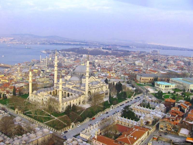


