
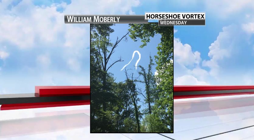

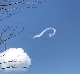
Yesterday, June 10th, there was a rare phenomenon in the sky near Louisville! Below are two pictures that were submitted to WDRB. Do you know what kind of cloud that is?!


This is one of the rarest clouds ever and most fascinating sights: This is a horseshoe vortex cloud! They are in the shape of "U" and will only last a few minutes. In these pictures from yesterday, there is notable spin, similar to a rope tornado.
There is a delicate recipe to create this fascinating sight that is not seen every day! They can be formed on a day when there is both directional and speed wind shear, stronger winds aloft and cumulus clouds present. Part of a cumulus cloud is pushed up by a warm column of rising air and a horizontal vortex develops due to the air rising at different speeds within the cloud. As this vortex climbs, the middle part catches the faster wind speeds aloft with the ends being slower. The different updraft speeds also gives the cloud a bit of spin within the cloud.
According to WDRB Chief Meteorologist Marc Weinberg, they are so rare, that this is the first time he has even seen one before in our area! They are hard to capture on camera because they do not last very long and the cumulus cloud dissipates quickly. I had to do some research in order to write this blog, but that is what I love about meteorology! I continue to learn more and more with each passing day and year! I hope you enjoyed learning about it, too!


